Seven Coloured Earth photos, the best light and Chamarel’s drone rules
Seven Coloured Earth photos come out best in direct sun, ideally soon after the geopark opens at 08:30 (checked on 29 October 2026) or when the sun returns after rain, because grey skies make the reds and purples look muddy. Chamarel Waterfall is fullest from December to April and is seen from two railed viewpoints, and the views over Le Morne Brabant and the Black River Gorges need a clear sky. Drones are banned at the geopark unless authorised in advance, and Mauritius’s civil aviation rules bar leisure flights over any place the public can access.
Read the guide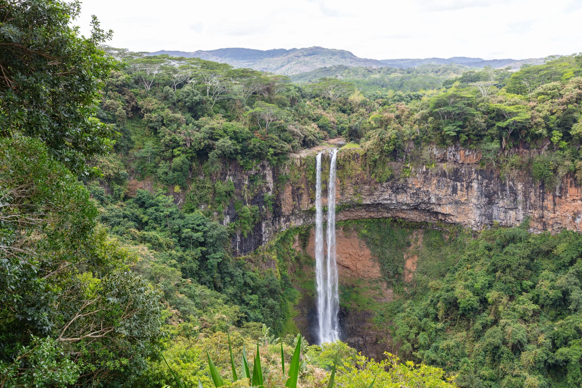
Where to take Seven Coloured Earth photos
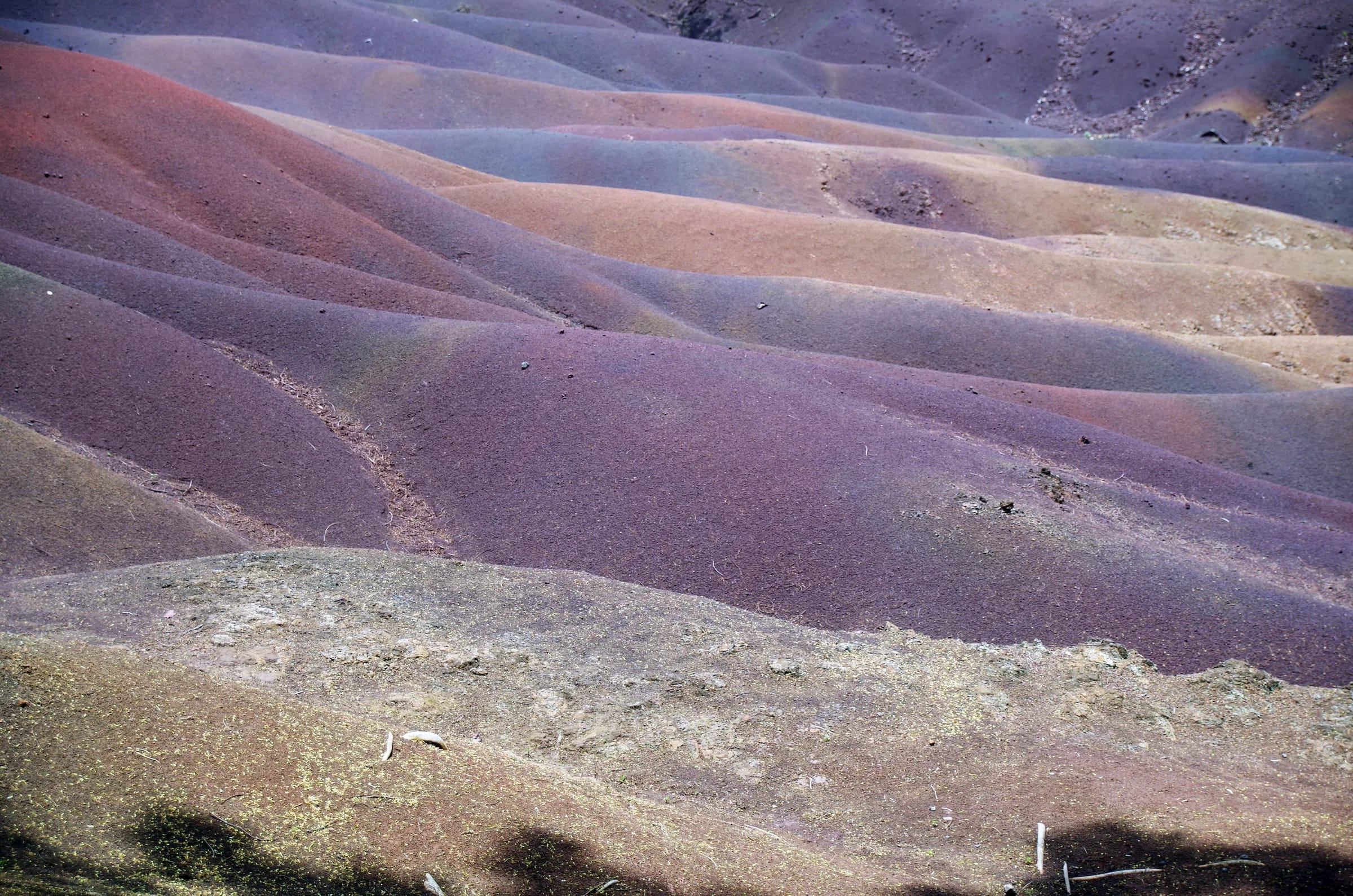
Seven Coloured Earth photos are taken from the fenced walkway and the viewing points around the edge of the dunes inside the Chamarel 7 Coloured Earth Geopark, so the best pictures come from walking the whole perimeter and choosing where the ridges and colour bands line up against the forest behind. You must stay on the marked paths and the perimeter, and walking on the coloured earth is strictly prohibited, so there is no shot from the middle of the dunes.
Light matters more than position. The colours are most vivid in direct sun and show best when sunshine follows rain, a polarising filter deepens them, and overcast days flatten them into browns. Morning is the safer bet. The geopark itself suggests mornings or late afternoons, but mountain shadow dulls the dunes late in the afternoon, so an 08:30 arrival on a clear day gives the best light and the emptiest walkway. Personal photography and video are allowed, and commercial shoots need the management’s approval.
Chamarel Waterfall from the two viewpoints
Chamarel Waterfall is photographed from two railed viewpoints inside the Chamarel 7 Coloured Earth Geopark, a lower platform a few steps from the waterfall car park and an upper one up a flight of steps, with a slightly better and quieter view. From either, the fall drops about 95 to 100 m, 83 m in some records, over a vertical cliff into a wide amphitheatre of rock and forest, with a small water-carved cave and spray that can rise about halfway up.
The light is less settled than at the dunes. The afternoon sun reaches the fall itself, the geopark suggests mornings or late afternoons, and nobody publishes which way the cliff faces, so the flow matters more than the clock. The fall is fullest from December to April and can split into two thinner streams in the drier months, as it does in early October, but even then it keeps flowing. The foot of the fall is reached only on a guided hike, so independent photographs are taken from the viewpoints.
The Chamarel viewpoint and the Black River Gorges
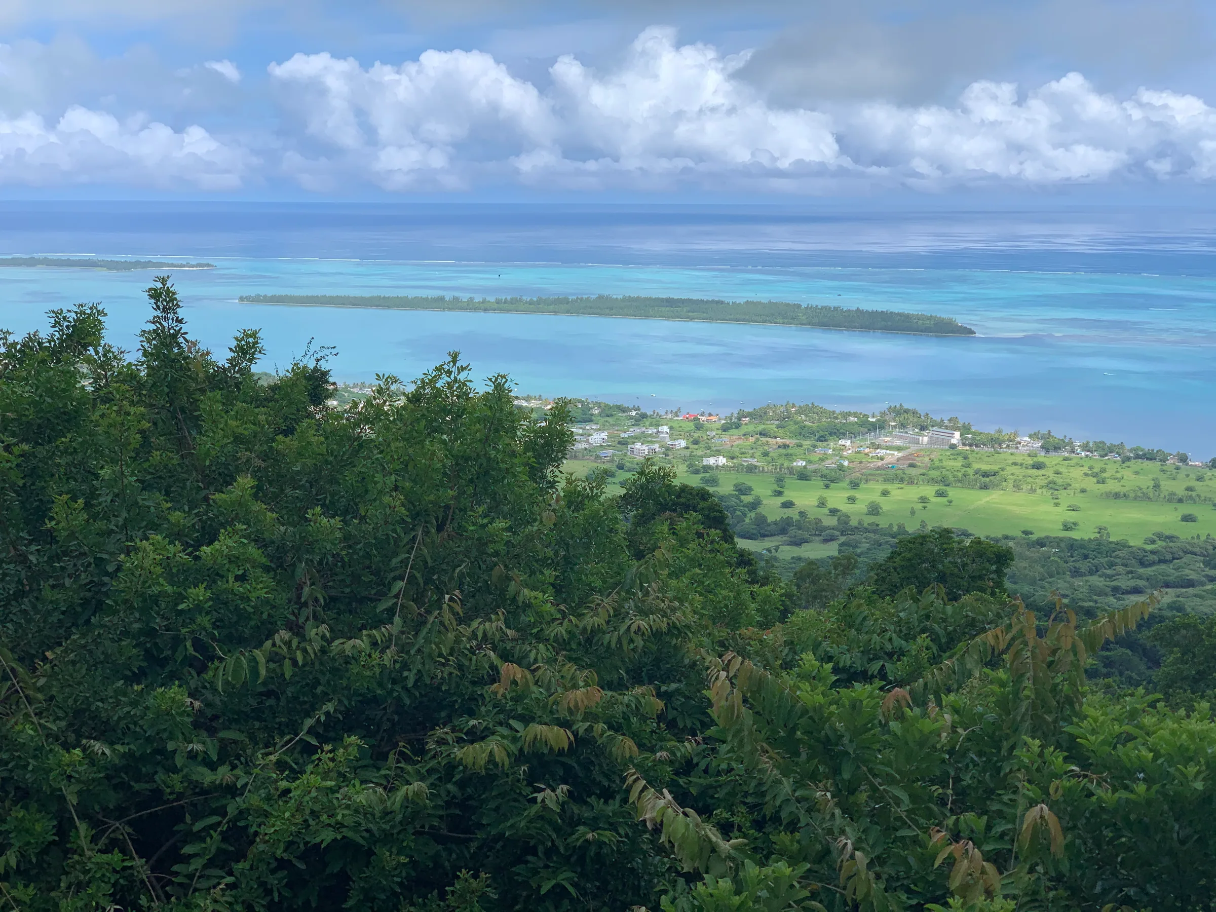
The two best-known views near Chamarel are the roadside Chamarel viewpoint above Case Noyale, looking over Le Morne Brabant, the lagoon and Île aux Bénitiers, and the Black River Gorges viewpoint on the Plaine Champagne road, looking down a forested gorge towards the west coast. Because the Chamarel viewpoint is a free roadside stop rather than a ticketed site, it can be photographed before the geopark opens and after it closes.
The Chamarel viewpoint has no parking bays, so cars and buses stop along the road with hazard lights on, and you should take your pictures well away from the traffic. At the Black River Gorges viewpoint a large free car park and a gentle path of about 200 m lead to the lookout, where macaques raid bags, so keep camera bags closed. Mist rises up the gorge like slow water and cloud sometimes hides it altogether, and rain arrives quickly from the interior, so plan for the morning.
Which light to wait for, subject by subject
Wait for sun on the Seven Coloured Earth, for the rainy season at the waterfall and for a clear sky at the viewpoints, and accept that the geopark’s opening hours rule out sunrise and sunset inside it.
| Subject | Light | Season | Watch for |
|---|---|---|---|
| Seven Coloured Earth | Direct sun, soon after the 08:30 opening or when the sun returns after rain | Any bright day, with clearer skies from May to November | Grey cloud that flattens the colours |
| Chamarel Waterfall | Sunlit; the afternoon sun reaches the fall, and the geopark suggests mornings or late afternoons | Fullest from December to April | Thin streams in the dry months |
| Chamarel viewpoint | Clear sky, at any hour | All year | No parking bays |
| Black River Gorges viewpoint | Clear sky, early in the day before the cloud builds | Drier months from May to November | Mist, cloud and macaques |
Drone rules at Chamarel and in Mauritius
Drones are not permitted at the Chamarel 7 Coloured Earth Geopark unless the management has authorised them in advance, and Mauritius’s Department of Civil Aviation bars leisure drones from any area the public can access, so the viewpoints around Chamarel are closed to casual flights as well. No-drone signs are posted at both the waterfall and the coloured earth, and commercial photo or video shoots at the geopark also need the management’s prior approval, through reservations@7colouredearth.mu.
The department’s drone FAQ lets leisure drones under 7 kg fly without its permission, but only within strict limits, and bringing a drone into Mauritius on holiday needs no special permission.
- Fly only in daylight and keep the drone within your line of sight.
- Fly only over private property with the owner’s permission, and no higher than 400 ft.
- Never fly over any area the public can access, beaches included, or in the vicinity of the airport.
- Respect the Data Protection Act when your camera captures other people.
- Commercial aerial work needs the department’s approval, priced at Rs 10,000 for three years or Rs 6,000 for a foreign operator, plus Rs 1,000 per location for a special permission (checked on 29 October 2026).
Questions people ask
When is the best time to photograph the Seven Coloured Earth?
The best time to photograph the Seven Coloured Earth is in direct sunshine, ideally soon after the geopark opens at 08:30 (checked on 29 October 2026) or when the sun returns after rain. Grey skies make the colours look muddy. The geopark suggests mornings or late afternoons, but mountain shadow dulls the dunes late in the day, so a sunny morning is the safer choice.
Can you fly a drone at the Seven Coloured Earth?
Drones are not permitted at the Chamarel 7 Coloured Earth Geopark unless the management has authorised them in advance, and no-drone signs are posted at the waterfall and at the coloured earth. Commercial shoots need prior approval too. Mauritius’s Department of Civil Aviation also bars leisure drones from any area the public can access, so an unauthorised flight breaks both sets of rules.
What are the drone rules in Mauritius?
The Department of Civil Aviation’s drone FAQ lets leisure drones under 7 kg fly without its permission, but only in daylight, within line of sight, over private property with the owner’s consent and below 400 ft, and never over areas the public can access, including beaches, or near the airport. Commercial aerial work needs the department’s approval, and the 2024 regulations add registration, so check the DCA website before travelling.
Where is the best spot for photos of Chamarel Waterfall?
The upper of the two Chamarel Waterfall viewpoints, up a flight of steps from the waterfall car park inside the Chamarel 7 Coloured Earth Geopark, gives a slightly better and quieter view than the lower platform. Both are covered by the geopark ticket. The fall is fullest from December to April, and in the drier months it can thin into two streams.
Can you photograph sunrise or sunset at the Seven Coloured Earth?
Sunrise and sunset cannot be photographed inside the Chamarel 7 Coloured Earth Geopark, which opens at 08:30 and closes at 17:00 or 17:30 (checked on 29 October 2026), while sunrise in Mauritius falls between about 05:22 and 06:45 and sunset between about 17:38 and 18:55. For golden-hour light, use the free roadside Chamarel viewpoint over Le Morne Brabant or Ebony Forest’s Sublime Sundowner.
Do you need permission for a photo shoot at Chamarel?
A commercial photo or video shoot at the Chamarel 7 Coloured Earth Geopark needs prior approval from the park’s management, which takes enquiries at reservations@7colouredearth.mu. Personal photography and video need no permission. Drone filming is a separate matter, because the geopark requires advance authorisation and commercial aerial work in Mauritius also needs Department of Civil Aviation approval.
Check the light before you go
The weather page sets out rain, cloud and temperature on the hill month by month.