
How to get to Chamarel by car, bus and taxi
The simplest way to get to Chamarel is by car or taxi up the B104 from Case Noyale on the west coast, about 43 km and 40 to 45 minutes from the airport and about 14 km and 18 minutes from Le Morne. Buses reach the village only on infrequent country routes with no published timetable, and the sights are spread over several kilometres of hill road. This page covers the three roads up, drive times from the main bases, buses, taxis, parking, fuel and cash.
Read the guide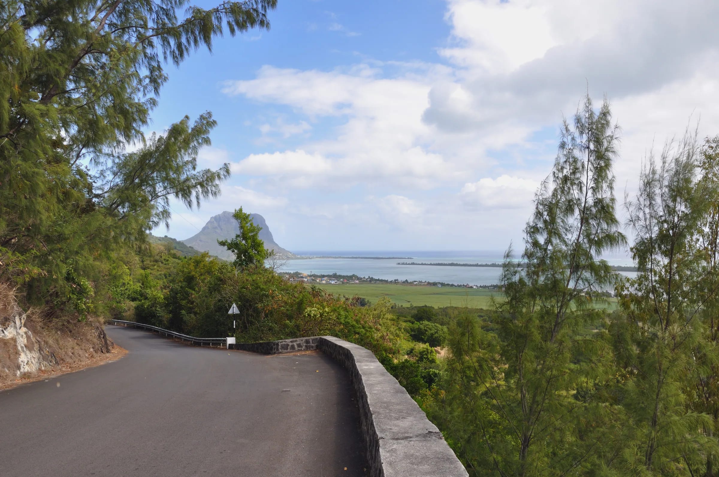
How to get to Chamarel, the three roads up
Three roads lead to Chamarel, the B104 hairpin climb from Case Noyale on the west coast, the B104 from Baie du Cap on the south coast, and the B103 Plaine Champagne road across the plateau from Grand Bassin and Le Pétrin. Case Noyale is the natural approach from the west coast and the north, Baie du Cap from the south coast, and the plateau road from the centre and the east of the island.
Chamarel sits at about 260 m on a wooded plateau above the west coast, and its sights are strung along these roads rather than gathered in the village. The map below shows each sight with a rough drive time from the Seven Coloured Earth gate and links that open directions in Google Maps.
Distances are straight lines from Chamarel village. Roads wind, so the drive is longer.
The B104 from Case Noyale, the usual way up
The B104 from Case Noyale is the usual way up from the west coast, leaving the B9 coast road at Case Noyale and climbing about 4 km and roughly 300 m in hairpin bends. The Chamarel viewpoint is on the right shortly before the village.
The road was built in the 1800s by Benoni Le Père de La Butte, who acquired the Case Noyale estate in 1824. A 1.4 km section between Case Noyale and the village, with a steep mountainside on one side and ravines on the other, was closed in both directions from September 2021 for landslide and slope-stability works, and Prime Minister Pravind Kumar Jugnauth inaugurated the rebuilt section shortly before 3 December 2022. The road is rebuilt and well signposted, and no road works notice has been published for it for 2025 or 2026.
Drive it in low gear and expect coaches on the bends. The corners are slippery when wet, the road is narrow in places and local traffic stops often, so allow more time than the drive times below suggest, particularly after rain.
The roads from Baie du Cap and from the plateau
The B104 from Baie du Cap climbs about 11 km north to Chamarel through short, steep ascents and descents and forest hairpins, and it passes the Seven Coloured Earth gate before it reaches the village.
The hairpins on this side are slippery when wet, and sections average roughly 10 to 11 per cent. Baie du Cap is about 7 km from Le Morne along the coast, so this road and the Case Noyale climb make a loop.
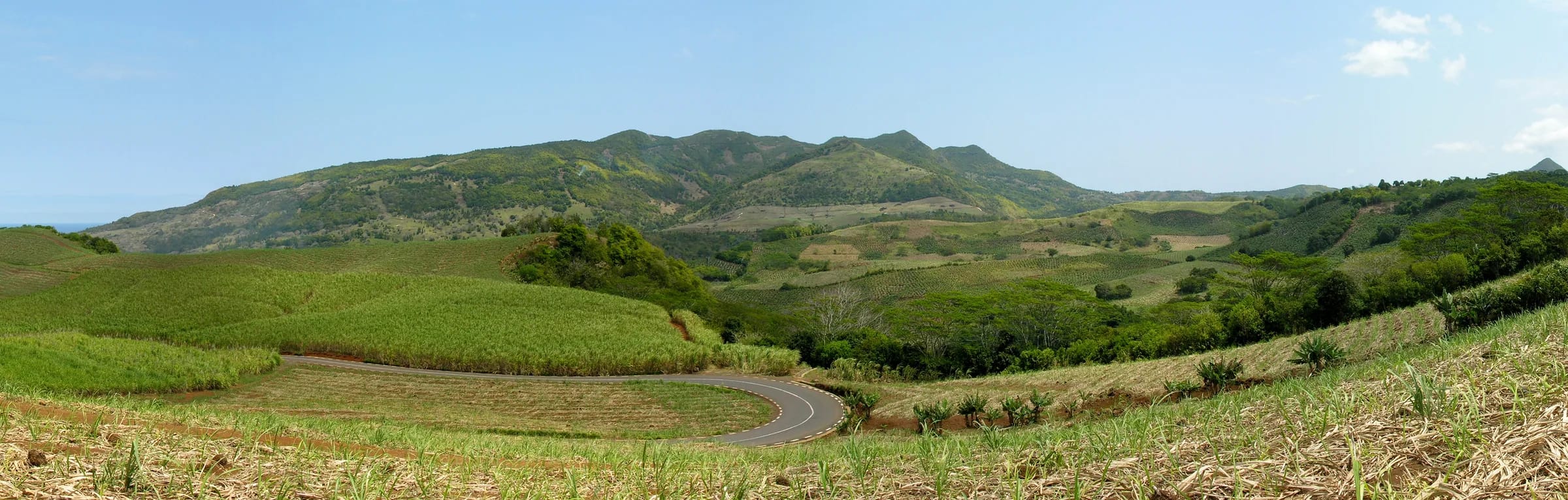
The B103 Plaine Champagne road leaves the village to the east and climbs onto the plateau, topping out at about 740 m, past the Black River Gorges viewpoint and Alexandra Falls towards Le Pétrin and Grand Bassin, 16.8 km and about 16 minutes from Chamarel. Cloud sits on this road on many days, macaques gather at the viewpoints, and the wild-guava season from 15 April to 15 May brings heavy traffic and badly parked cars.
Drive times to Chamarel from the airport and the resorts
Driving to Chamarel takes about 40 to 45 minutes from the airport, 45 minutes from Port Louis, a little over an hour from Grand Baie, about 30 minutes from Flic en Flac and 18 minutes from Le Morne. These are road times without stops.
Treat the times as minimums, because the hairpins, coaches and village traffic slow real journeys. Lodges outside the village add to that, and the airport transfer to one of them runs to 1 hour 25 minutes.
| From | Distance | Time |
|---|---|---|
| SSR International Airport | 42.9 to 45 km | About 40 to 44 minutes |
| Port Louis | About 42 km | About 45 minutes, up to 1 h 15 |
| Grand Baie | About 63 km | About 1 h 05, up to 1 h 30 |
| Flic en Flac | About 27 km | About 30 minutes |
| Tamarin | 15.8 km to the Rhumerie, 17.3 km to the falls | No time published |
| Le Morne | About 14 km | About 18 minutes |
| Mahébourg | 45 to 46 km | About 42 to 43 minutes |
The Chamarel bus routes
The Chamarel bus routes are the 5A from Baie du Cap to the Sainte-Anne church and the 243 from Quatre Bornes, which follows the same route as the 5A. Both are infrequent country services, and no official timetable is published for either.
Routes 5A and 243 serve the village in the published route lists; check times locally. The stop names in circulation, Chamarel Village and Saint Anne Church, are not official. To reach the foot of the hill, route 5 runs from Quatre Bornes along the west coast via Rivière Noire and Le Morne to Baie du Cap, stopping at Case Noyale, route 120 runs from Port Louis to Baie du Cap, and routes 133 and 133A run from Curepipe to Choisy and Baie du Cap about every 30 minutes. From Baie du Cap or Choisy, a taxi completes the journey up the hill.
Fares are paid in cash to the conductor, from Rs 12 to 17 for the shortest stage to Rs 37 to 47 for the longest. Rural buses run from about 06:30 to 18:30, but no last departure for the 5A or the 243 is published, so plan to leave the village by mid-afternoon and keep a taxi number as a fallback.
The bus also leaves you short of the sights. The geopark gate is about 1.5 km south of the village and the dunes a further 3 km inside, so without a vehicle the walk is long.
Taxis and transfers to Chamarel
A taxi to Chamarel has no official fixed fare, so agree the price before you set off and use a licensed taxi, which carries a yellow door plate.
Prices vary widely. Airport transfers are quoted from Rs 1,200 to Rs 4,000, pre-booked transfers from the airport to Chamarel were advertised from €44.65 in October 2026, and dollar quotes for an airport taxi run from US$100 to 130. A taxi for the day costs Rs 3,000 to Rs 5,000, and a week’s hire brings that down to about Rs 3,500 a day.
A day hire suits Chamarel well, because the sights are spread over several kilometres and the driver waits while you visit, which also solves the return from a village with few buses.
Parking, fuel and cash
Chamarel’s main sights have their own parking, but the village has no fuel station and no cash machine, so fill up and draw rupees on the coast.
The Chamarel Seven Coloured Earth Geopark has two car parks, one at the waterfall viewpoint and one by the dunes, and charges entry per person rather than per car. The car parks fill with taxis and small coaches in the afternoon, but a space comes quickly. The Black River Gorges viewpoint has a large free car park, the Chamarel viewpoint has none, so cars pull in at the roadside with hazard lights on, and the Black River Peak trailhead takes only two or three cars.
Chamarel, Case Noyale, La Gaulette and Baie du Cap have no fuel station, so fill up at the Shell station in Black River or in Tamarin. The nearest cash machines are MCB and State Bank of India machines on the coast road at La Gaulette, open 24 hours, and MCB machines in Baie du Cap. The geopark takes cards and rupees in cash, not foreign currency. Phone signal works in the village and at the geopark but is unreliable on forest trails, so save an offline map.
Questions people ask
How do I get from the airport to Chamarel?
From SSR International Airport, Chamarel is about 43 km by road, 40 to 45 minutes without stops and longer to some lodges. No direct bus is published from the airport, so drive, or take a pre-booked transfer or a taxi. There is no official taxi tariff, and airport transfers in October 2026 are quoted at Rs 1,200 to Rs 4,000.
Is there a bus to Chamarel?
Yes, but not often. Route 5A runs from Baie du Cap to Chamarel’s Sainte-Anne church and route 243 from Quatre Bornes follows the same route, but no official timetable, frequency or last departure is published, so check times locally. Rural buses run from about 06:30 to 18:30. From the village it is still about 1.5 km to the geopark gate and 3 km more to the dunes.
How do I get from Le Morne to Chamarel?
By car, Le Morne to Chamarel is about 14 km and roughly 18 minutes, north along the coast road to Case Noyale and up the B104 hairpins. By bus, route 5 between Quatre Bornes and Baie du Cap runs via Le Morne, and route 5A climbs from Baie du Cap to Chamarel, but no timetable is published, so a taxi is far more practical.
Is the road to Chamarel dangerous?
The road to Chamarel is a steep, winding hill road that needs care, especially in rain. The B104 from Case Noyale climbs about 300 m in hairpins, its corners are slippery when wet, coaches use it, and a 1.4 km section was rebuilt after a landslide closure that began in September 2021. Take it slowly, especially after rain, and give the coaches room on the bends.
How much is a taxi to Chamarel?
A taxi to Chamarel has no official tariff in Mauritius, so agree the price with the driver before leaving. In October 2026 an airport transfer is quoted at Rs 1,200 to Rs 4,000 and a taxi for the day at Rs 3,000 to Rs 5,000. Licensed taxis carry a yellow door plate, and a day hire means the driver waits while you visit.
Where do you park in Chamarel?
The Chamarel Seven Coloured Earth Geopark has two car parks, at the waterfall viewpoint and by the dunes, and charges entry per person rather than per car. The Black River Gorges viewpoint has a large free car park on the B103. The Chamarel viewpoint over Le Morne has no marked parking, so cars stop on the roadside with hazard lights on, which needs care on the bend.
Is there a petrol station or ATM in Chamarel?
Chamarel village has no petrol station and no cash machine. The nearest fuel is in Black River, at a Shell station, and in Tamarin, and the nearest cash machines are on the coast at La Gaulette, with more in Baie du Cap. The geopark accepts cards and rupees in cash but not foreign currency, so arrive with a full tank and some rupees.
See where everything is
The map shows every sight with a rough drive time from the geopark and links to directions.