
Chamarel Waterfall, its two viewpoints and when it flows best
Chamarel Waterfall is a single drop of about 95 to 100 m, with 83 m also on record, and you see it from two railed viewpoints inside the Chamarel Seven Coloured Earth Geopark, whose ticket costs Rs 800 for non-resident adults and Rs 400 for children aged 5 to 11 (checked on 29 October 2026). The viewpoints are a few steps from their own car park, 1.5 km by car from the geopark gate, so you do not have to hike. The fall runs fullest from December to April and thins in the dry months, and there is no public path to its base, which is reached only on a guided descent.
Read the guide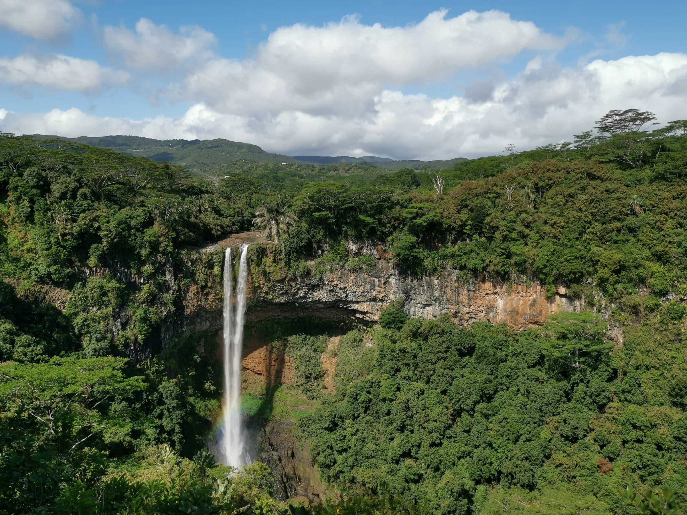
How tall is Chamarel Waterfall?
Chamarel Waterfall is about 95 to 100 m tall, the tallest single drop in Mauritius. The figures on record are 95 m in the UN Tourism profile of the village, nearly 100 m in the geopark’s own account and 83 m elsewhere, and none of them says how the drop was measured, so treat the height as roughly 83 to 100 m.
The fall is also called Chamarel Falls in English and the Cascade de Chamarel in French. It leaps from a vertical cliff into an amphitheatre of rock and forest, where the water has carved a small cave and the spray can rise to about half the height of the drop. The fall is fed by the Saint-Denis and Viande Salée streams, three separate streams in the geopark’s count, and below it the river runs south to the sea at Baie du Cap, known as the Baie du Cap River or the River du Cap.
The two Chamarel Waterfall viewpoints
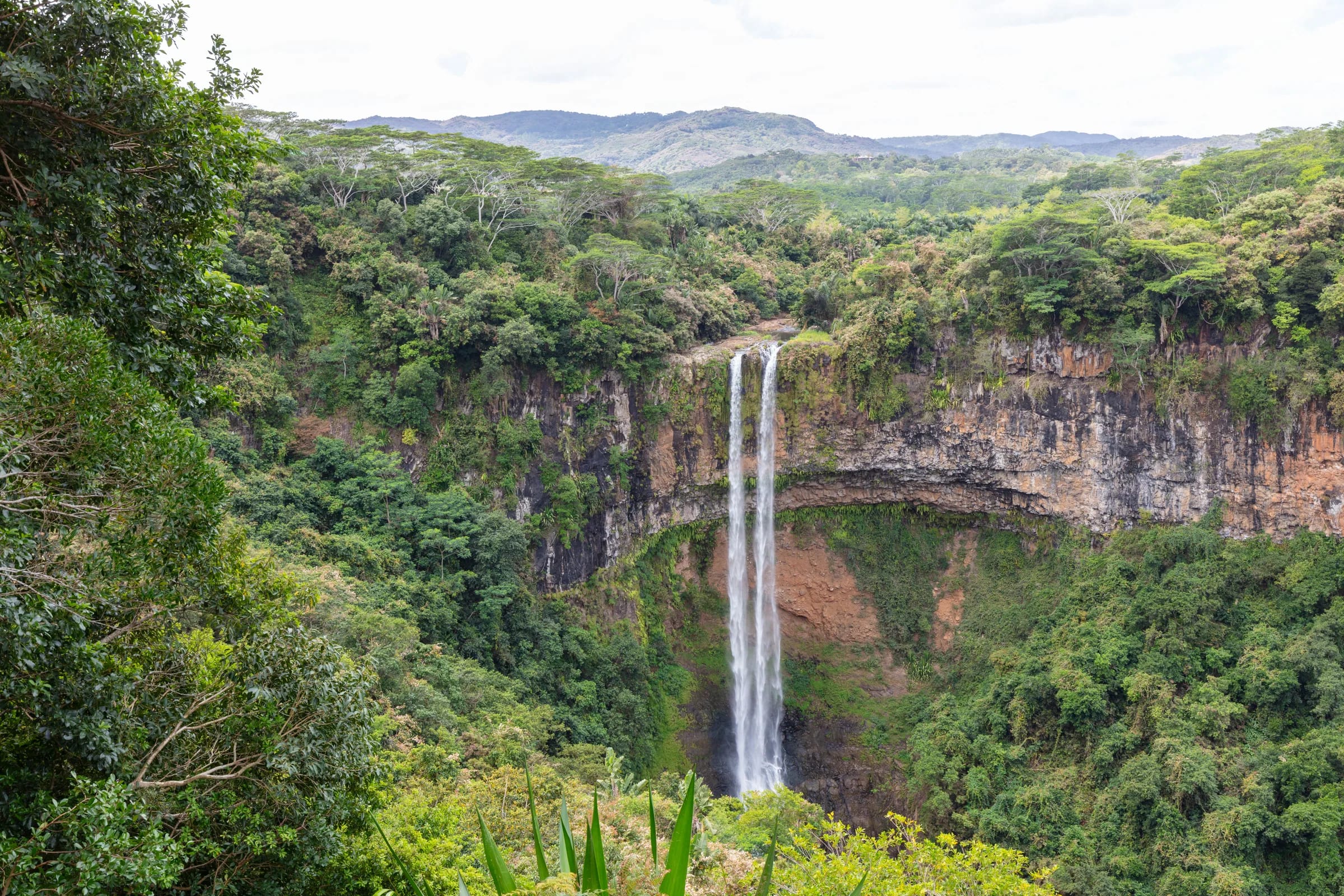
The Chamarel Waterfall viewpoints are two railed platforms inside the Chamarel Seven Coloured Earth Geopark, a lower one a few steps from the waterfall car park and an upper one up a short flight of stairs, with a slightly better view. The whole paved path is about 0.2 km, the railings are sturdy and the visit suits families. The upper deck is split into two closely spaced lookouts joined by uneven steps, so take care there with small children and in wet shoes.
The platforms stand about 240 m west of the fall and look east across the gorge, so the whole drop is in view at once. No hike is needed, and the platforms are the end of the public path. The geopark has two car parks, one at the waterfall viewpoints and one at the coloured earth.
The waterfall viewpoints are not the free roadside Chamarel viewpoint over Le Morne and the lagoon, which sits on the road up from Case Noyale just before the village and looks out over the coast rather than the fall.
Chamarel Waterfall entrance fee and how to reach it
Chamarel Waterfall has no ticket of its own, because its viewpoints are inside the Chamarel Seven Coloured Earth Geopark, which charges non-residents Rs 800 per adult and Rs 400 per child aged 5 to 11, charges Mauritian residents Rs 400 per adult and Rs 200 per child, and lets children under 5 in free (checked on 29 October 2026). The geopark opens every day, Sundays and public holidays included, from 08:30 to 17:30 between October and May, with the last ticket at 17:00, and from 08:30 to 17:00 between June and September, as the table below shows.
The same ticket covers the coloured earth, the giant tortoise park and the endemic garden, but not the guided hike to the base of the fall. Tickets are dated, valid for one entry, non-transferable and non-refundable. Payment is in Mauritian rupees, in cash, by card except Diners Club or through the local Juice, Pop and Blink apps, and foreign cash is refused.
To reach the viewpoints, drive or take a taxi to the geopark gate on the B104, about 1.5 km south of Chamarel village, buy tickets at the main entrance or the drive-through booth, then drive 1.5 km inside the park to the waterfall car park. The coloured earth is 3 km from the gate, a walk of about an hour one way, so with a car it makes sense to drive between the two. By road Chamarel is about 18 minutes from Le Morne, 30 minutes from Flic en Flac and 40 minutes from the airport. No bus timetable to the village is published, so a car or taxi is the practical way in.
| Days | Hours |
|---|---|
| Monday to Sunday | 08:30 to 17:30 |
| Days | Hours |
|---|---|
| Monday to Sunday | 08:30 to 17:00 |
The viewpoints are inside the geopark, 1.5 km from the entrance by car, and share its hours and ticket.
How the flow changes through the year
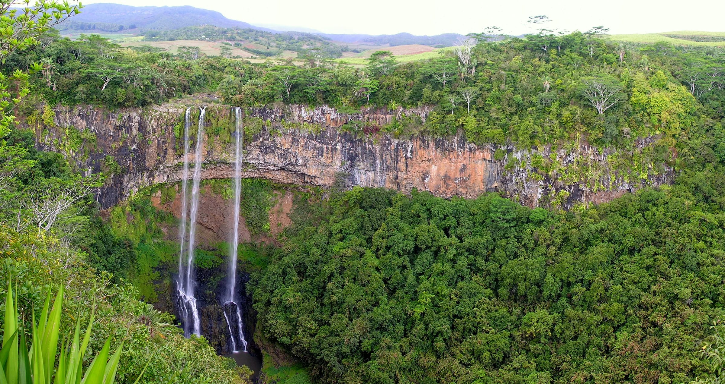
Chamarel Waterfall runs fullest from about December to April, in the rainy summer, and thinner from May to November, when it can split into two narrow streams. Accounts of the peak differ only at the edges, December to April, December to March or January to April. In the drier months the fall divides in two, as it does in the photograph below from early October. In August 2025 it still carried a moderate amount of water. There is no record of the fall running dry, but it was fairly dry in January 2013, so even a wet-season visit is not a guarantee.
Rainfall explains the pattern. Mauritius Meteorological Services’ averages for 1991 to 2020 give the south of Mauritius 374 mm in February against 101 mm in October, and the dry west coast 202 mm against 23 mm. No rain gauge is published for Chamarel itself, which lies between the dry coast and the wetter southern uplands, so the two columns in the table bracket what the catchment above the fall receives.
The live board below estimates today’s flow from modelled rainfall over the catchment above the fall during the last day, week and month. It is an estimate from weather data, not a gauge reading, so use it to set expectations before you drive up.
| Month | West coast | South | What to expect at the fall |
|---|---|---|---|
| January | 195 mm | 324 mm | Full, in the rainy season |
| February | 202 mm | 374 mm | Fullest, the wettest month |
| March | 155 mm | 352 mm | Full, still very wet |
| April | 80 mm | 269 mm | Full, starting to ease |
| May | 42 mm | 195 mm | Lower |
| June | 27 mm | 159 mm | Lower |
| July | 20 mm | 188 mm | Lower |
| August | 20 mm | 149 mm | Moderate |
| September | 24 mm | 114 mm | Low |
| October | 23 mm | 101 mm | Driest month, can split into two streams |
| November | 38 mm | 114 mm | Low |
| December | 96 mm | 227 mm | Rising as the rains start |
A wet day on the plateau
Heavy rain, storms or strong gusts are forecast. The hairpin road is slower in rain, the viewpoints will show little and the waterfall path turns to mud. The geopark, the rhumerie and Curious Mauritius still work in rain.
No closure notice
The best time of day at the fall
Soon after opening is the quiet time at Chamarel Waterfall, and the afternoon is the sunlit one. The platforms look east across the gorge, so the face of the fall turns towards the afternoon sun and is lit on a clear afternoon, while the Chamarel Seven Coloured Earth Geopark’s own advice is mornings or late afternoons for cooler air and better light. The geopark opens at 08:30 and closes by 17:30 (checked on 29 October 2026), so sunrise and sunset are never possible from the platforms.
Crowds follow the coaches. The viewpoint is quiet until about 10:00 and busier after that, and in the afternoon the geopark car park fills with taxis and small coaches. Cruise ships calling at Port Louis sell coach excursions to Chamarel, so expect more company on those days. Arriving soon after opening gives the best chance of a quiet rail.
Can you walk to the bottom of Chamarel Waterfall?
You cannot walk to the bottom of Chamarel Waterfall on your own, because there is no public path to the base and the Chamarel Seven Coloured Earth Geopark states that going down the waterfall on your own is strictly prohibited. The geopark ticket covers the two viewpoints only. The base is reached on guided hikes, sold as outings of about 3 hours that meet at the geopark car park, and the descent itself takes about 45 minutes on a forest path that is slippery in places.
The guided hikes advertise a swim in the pool at the foot of the fall. Unpredictable currents and the risk of flash floods argue against it. The waterfall hike page covers the descent, the swimming question and what is still unpublished about the path.
A few other geopark rules apply at the viewpoints and across the site.
- Drones are not allowed unless the geopark has authorised the flight in advance, and no-drone signs have stood at the waterfall since at least 2019.
- Pets are not allowed, except registered service animals.
- Picnics, smoking, alcohol and amplified music are not allowed.
- Commercial photo and film shoots need the geopark’s approval in advance, while personal photos are allowed.
Questions people ask
How much does it cost to visit Chamarel Waterfall?
Visiting Chamarel Waterfall costs the price of the Chamarel Seven Coloured Earth Geopark ticket, because the two viewpoints are inside the geopark. The ticket is Rs 800 for non-resident adults, Rs 400 for non-resident children aged 5 to 11, Rs 400 and Rs 200 for resident adults and children, and free for children under 5 (checked on 29 October 2026). The same ticket covers the coloured earth and the giant tortoises, but not the guided hike to the base.
Do you have to hike to see Chamarel Waterfall?
No hike is needed to see Chamarel Waterfall. The lower viewpoint is a few steps from the waterfall car park inside the Chamarel Seven Coloured Earth Geopark, 1.5 km by car from the gate, and the upper viewpoint is up a short flight of stairs, on a paved path of about 0.2 km in all. Only the guided descent to the base of the fall is a real hike, and going down alone is prohibited.
How do you get to Chamarel Waterfall?
Chamarel Waterfall is reached by car or taxi through the Chamarel Seven Coloured Earth Geopark gate on the B104, about 1.5 km south of Chamarel village. After buying tickets, drive 1.5 km inside the park to the waterfall car park, where the viewpoints are a few steps away. By road Chamarel is about 18 minutes from Le Morne and 40 minutes from the airport, and no bus timetable to the village is published.
Is Chamarel Waterfall flowing in October?
Chamarel Waterfall still flows in October, but October is the driest month in Mauritius, the fall is then at its thinnest and it can split into two narrow streams. The strongest flow comes between December and April, and there is no record of the fall running completely dry. The live board on this page estimates the current flow from recent rainfall over the catchment above the fall.
Can you swim at Chamarel Waterfall?
Swimming at Chamarel Waterfall is only possible in the pool at its base, which can be reached only on a guided hike, since the Chamarel Seven Coloured Earth Geopark prohibits going down alone. The guided hikes advertise a swim, but the pool has unpredictable currents and a risk of flash floods, so do not count on it. There is no swimming at the viewpoints, which look across the gorge from about 240 m away.
Is Chamarel Waterfall open on Sundays?
Chamarel Waterfall’s viewpoints are open on Sundays and public holidays, because the Chamarel Seven Coloured Earth Geopark opens every day. Hours are 08:30 to 17:30 from October to May, with the last ticket at 17:00, and 08:30 to 17:00 from June to September (checked on 29 October 2026). The park closes during cyclone warnings and very heavy rain, so check the weather before driving up in summer.
Can you fly a drone at Chamarel Waterfall?
Drones are not allowed at Chamarel Waterfall unless the Chamarel Seven Coloured Earth Geopark has authorised the flight in advance, and the geopark’s own FAQ says flatly that drones are not allowed. Commercial shoots need management approval. No-drone signs have stood at the waterfall and the coloured earth since 2019, and national civil aviation rules also bar leisure drones over areas open to the public.
Thinking of the base?
The guided descent to the foot of the fall has its own page, with what the walk involves and what is still unpublished.