
Chamarel village, its church and where the name comes from
Chamarel village lies about 260 to 300 m above sea level in the hills of south-west Mauritius, mainly in Rivière Noire district with its eastern part in Savanne, and its village council area counted 755 residents in 2022. The village takes its name from Charles Antoine de Chazal de Chamarel, whose family received the land in the 1780s, and its Sainte-Anne church is dated 1876. The sights most visitors come for, the rum distillery, the waterfall and the coloured earth, lie 0.6 to 2.7 km from the village centre in a straight line, and in 2025 UN Tourism listed Chamarel among its Best Tourism Villages.
Read the guide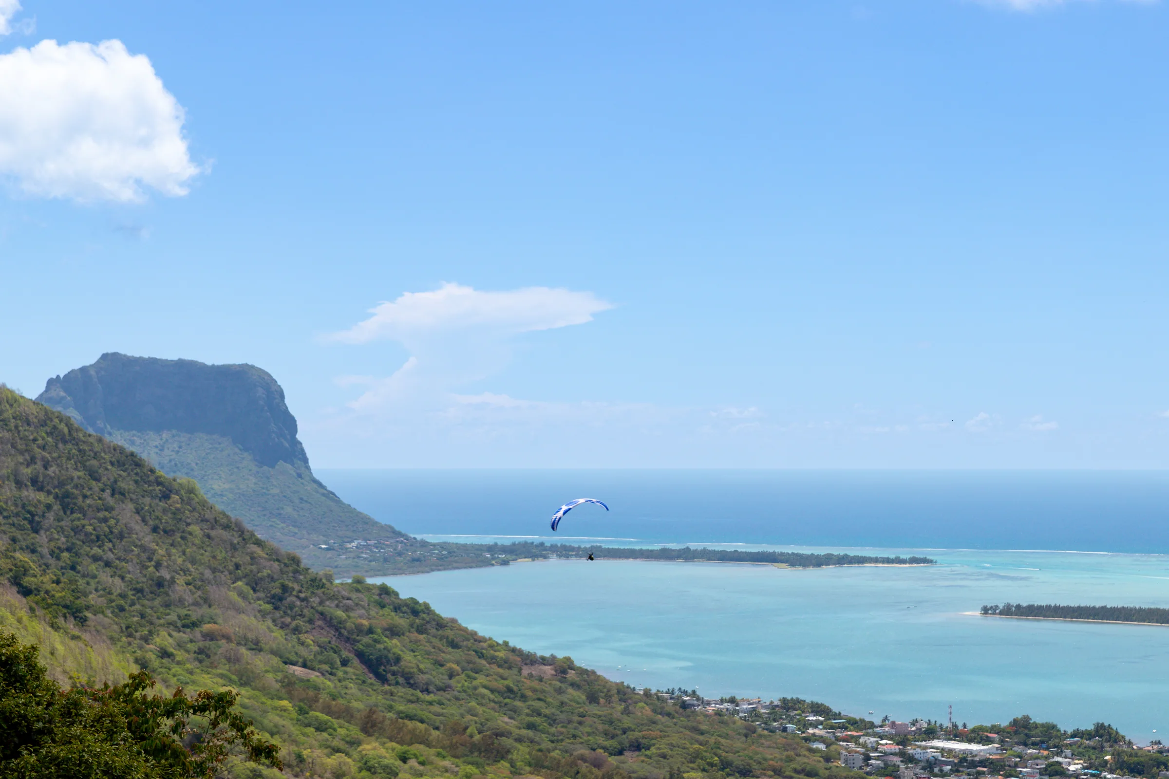
Where Chamarel is and how high it sits
Chamarel sits on a wooded plateau about 260 to 300 m above sea level in the hills of south-west Mauritius, just below the higher Plaine Champagne uplands and above the west coast at Case Noyale. The village centre is at 20.4253° S, 57.3913° E, about 3.2 km in a straight line from Case Noyale on the coast.
The published heights differ because the village spreads across a slope and each figure describes a different spot. The village is given as 260 m and as 283 m, the coffee plantation grows at 280 m, and the Rhumerie de Chamarel puts its valley about 300 m above the coast, so about 260 to 300 m covers the village.
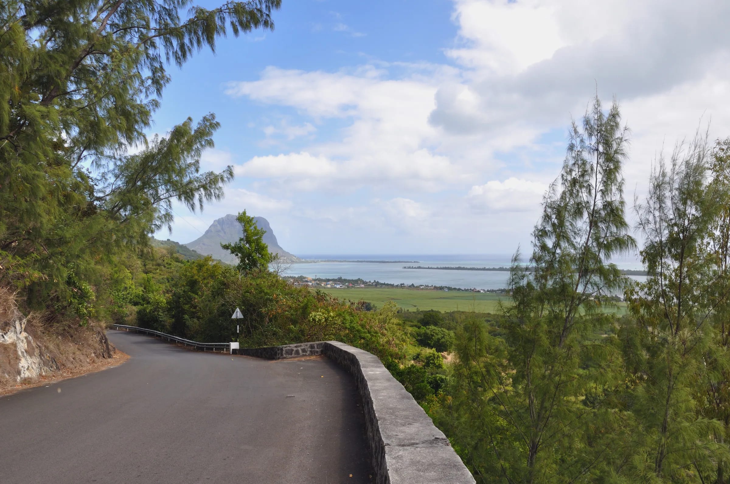
Two roads meet in the village. The B104 climbs about 4 km from the coast road at Case Noyale, gaining roughly 300 m through hairpin bends, and continues south to Baie du Cap. The B103, the Plaine Champagne road, passes the Sainte-Anne church and climbs east to a summit of 740 m on its way to the Black River Gorges and Grand Bassin.
In a straight line, the main sights all lie within 3 km of the village centre. The Rhumerie de Chamarel is 0.6 km away, the geopark ticket booth and Curious Mauritius 1.5 km, the waterfall 2.0 km, Ebony Forest 2.4 km and the coloured dunes 2.5 to 2.7 km. By road the airport is 42.9 km away, about 40 minutes.
In which district is Chamarel located?
Chamarel is located mainly in Rivière Noire district, also called Black River district, and its eastern part lies in Savanne district. The village has its own Chamarel Village Council, which comes under the Rivière Noire District Council.
The split shows on the map as two village council areas, Chamarel VCA West in Black River and Chamarel VCA East in Savanne. Some sights that carry the Chamarel name sit outside the village area altogether, and the Chamarel waterfall, for example, is in the Baie du Cap council area of Savanne.
Rivière Noire district as a whole covers 259 km² and had an estimated 80,939 residents on 31 December 2015.
How many people live in Chamarel
About 750 people live in Chamarel, and the census of 3 July 2022 counted 755 residents, 367 male and 388 female, in the Chamarel village council area of Rivière Noire district.
The total rose between the 2000 and 2011 censuses and dipped slightly by 2022. The 2011 count is 784 in the Central Statistical Office series and 783 in the Statistics Mauritius figure, with a density of 26.5 people per km², and a rounded figure of about 700 is also in circulation. The newest figure is the Central Statistical Office count as republished, not the original census report, and no separate count is published for the small eastern part of the village in Savanne district.
| Census date | Residents | Counted by |
|---|---|---|
| 2 July 2000 | 625 | Central Statistical Office |
| 3 July 2011 | 784, or 783 in the Statistics Mauritius figure | Central Statistical Office and Statistics Mauritius |
| 3 July 2022 | 755 | Central Statistical Office |
The Chamarel church of Sainte-Anne
The Chamarel church is the Roman Catholic Église Sainte-Anne, which stands in the village centre on the B103 with a statue of Saint Anne in front, and its first chapel is dated 1876.
The record gives two dates. The chapel is dated 1876, in UN Tourism’s 2025 village profile among others, while the parish listing for the Diocese of Port-Louis carries the date 1971 with no explanation. A parish created in 1971 in an 1876 chapel would reconcile the two, but nothing on record confirms it, so 1876 stands for the chapel and 1971 stays unexplained.
No visiting hours are published. Treat Sainte-Anne as a parish church in use rather than a sight with a timetable, and stay at the back if a service is under way.
Is the Sainte-Anne festival in July or on 15 August?
Chamarel’s church celebrations are recorded on two different dates, a Mass and fair on the last Sunday of July and a pilgrimage on 15 August, and nothing on record reconciles them.
The July event, as held in 2019, is a Mass in the church courtyard followed by a kermesse called the Fancy Fair, with stalls run by the nuns selling items for about Rs 20 at the time, jams, tea stalls, wild-boar salmi, venison, hare and chicken curry, and a folk band from about 15:00, drawing people from all over Mauritius. UN Tourism calls it the annual St. Anne Day fair, and a pilgrimage every July is also on record. Saint Anne’s feast day in the Catholic calendar is 26 July, which fits a late-July celebration.
The other record places the pilgrimage on 15 August, the feast of the Assumption, with a village fair and a dish called curry number two, and a second account ties the pilgrimage to the Assumption without naming a day. Both may take place. No 2025 or 2026 programme and no diocesan page is published, so ask at the church or in the village before planning a trip around either date.
Everyday life in Chamarel village
Everyday life in Chamarel village still turns on the land, with sugar cane, pineapple and Arabica coffee as the main crops and Creoles as the main workforce.
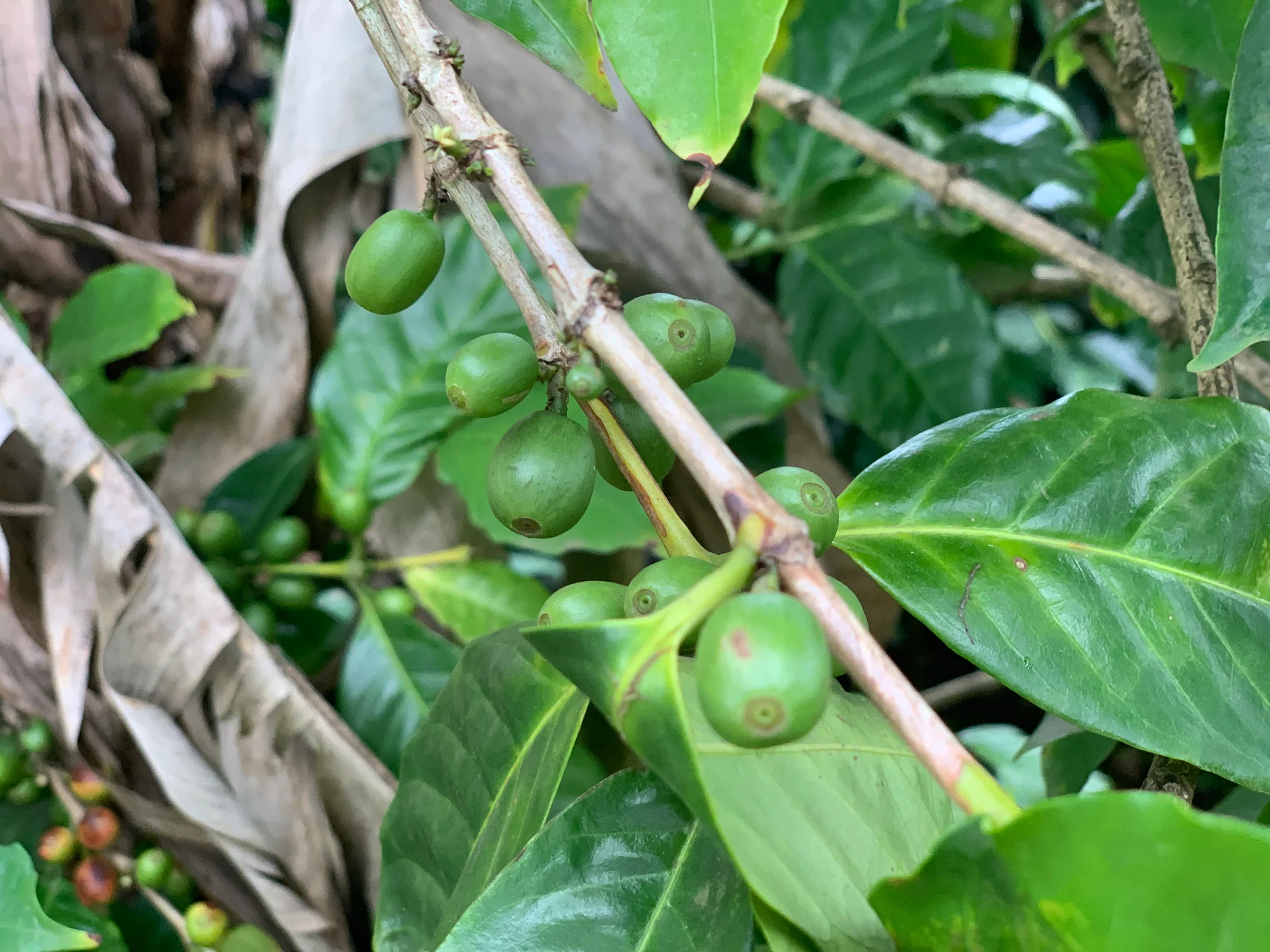
Tourism now sits alongside farming. The coffee plantation at the geopark employs about 30 seasonal pickers for the May to July harvest and more than 25 staff for fermenting, drying and roasting. Local crafts include basketry in vacoas fibre, wood carving and weaving. Village tables d’hôtes serve game, and a Rastafarian place of worship known as Triangle or La Rosselière has been in use since the 1980s.
A few practical facts shape a visit to the village.
- No cash machine is mapped in the village, and the nearest ATMs are on the coast road at Case Noyale and La Gaulette and in Baie du Cap.
- No fuel station is mapped in Chamarel, Case Noyale, La Gaulette or Baie du Cap, so fill up in Black River or Tamarin before driving up.
- Medical help is outside the village, with community health centres at La Gaulette and Baie du Cap and the public Dr Yves Cantin Community Hospital, spelled Catin in some lists, serving Rivière Noire district.
- In an emergency call the police on 999 or 112, the SAMU ambulance on 114 and the fire service on 115.
- Mobile signal works in the village and at the geopark but is unreliable on forest trails.
- Buses are sparse. Route 5A runs from Baie du Cap to the Saint Anne church and route 243 from Quatre Bornes, and neither has a published timetable.
Why UN Tourism listed Chamarel in 2025
UN Tourism listed Chamarel among its 52 Best Tourism Villages 2025 on 17 October 2025, picked from more than 270 applications from 65 member states, with Grand River South East as the other Mauritian village chosen.
The programme recognises villages that use tourism for rural development rather than ranking sights. Its profile of Chamarel cites the de Chazal de Chamarel family, the freed slaves who settled the valley, the 1876 chapel and the St. Anne Day fair, and it credits the geopark with waste sorting and turning used cooking oil into biofuel.
Some of the profile’s figures differ from the reserve’s own. It describes Ebony Forest as founded in 2017 on 34 ha, while Ebony Forest dates its restoration work to 2006 and now manages 195 ha. No new attraction is on record as opening in Chamarel since the listing, up to October 2026.
Chamarel meaning and where the name comes from
The name Chamarel is a family name rather than a description of the landscape, because the village is named after Charles Antoine de Chazal de Chamarel, who was born on the island in 1772, when it was the French colony of Isle de France.
He and his elder brother Toussaint-Antoine took over the land from their stepfather, Jean Louis Lousteau, and the concession is dated 1785 in the family record and 1786 in the geopark’s account. Charles-Antoine settled there around 1793. The land was sold more than once in the 19th century, to The Mauritius Estate & Assets in 1891, but the name stayed with the village.
The family name de Chamarel itself has no recorded meaning, so there is no translation to give.
Chamarel also carries a nickname. Freed slaves called it the Valley of Blacks, and some residents still call it the Valley of the Blacks, a reminder that the hill sheltered runaway slaves before abolition and became a place to settle afterwards.
Questions people ask
In which district is Chamarel located?
Chamarel is located mainly in Rivière Noire district, also called Black River district, in south-west Mauritius. The eastern part of the village area lies in Savanne district, and the map shows the two parts as Chamarel VCA West and Chamarel VCA East. Chamarel has its own village council under the Rivière Noire District Council, while the nearby Chamarel waterfall is in the Baie du Cap council area of Savanne.
What does the name Chamarel mean?
The name Chamarel is a family name. The village is named after Charles Antoine de Chazal de Chamarel, born on the island in 1772, who took over the land with his brother in 1785 or 1786, the two dates in the record, and settled there around 1793. The family name itself has no recorded meaning. Chamarel also has a nickname, the Valley of Blacks, given by the freed slaves who settled it.
How old is the church in Chamarel?
The Sainte-Anne church in Chamarel is dated 1876, the year of its first chapel. The parish listing for the Diocese of Port-Louis carries the date 1971, which would fit the creation of the parish, though nothing on record confirms that. The church stands in the village centre on the B103, with a statue of Saint Anne in front.
When is the Sainte-Anne fair in Chamarel?
The Sainte-Anne fair in Chamarel is a Mass on the last Sunday of July followed by a kermesse called the Fancy Fair, with game dishes, jams and a folk band, as held in 2019. The other date on record for the village pilgrimage is 15 August, the feast of the Assumption. No 2025 or 2026 programme is published, so confirm the date in the village before planning a visit around either celebration.
How many people live in Chamarel?
Chamarel’s village council area in Rivière Noire district had 755 residents at the census of 3 July 2022, 367 male and 388 female, in the Central Statistical Office count. The 2011 census counted 784, or 783 in the Statistics Mauritius figure, and the 2000 census counted 625. No separate count is published for the small part of the village in Savanne district.
How high is Chamarel above sea level?
Chamarel village lies about 260 to 300 m above sea level. The village is given as 260 m and as 283 m, the coffee plantation grows at 280 m and the Rhumerie de Chamarel puts its valley about 300 m above the coast. The Plaine Champagne road above the village climbs to 740 m, and the plateau is noticeably cooler than the coast, so bring a layer.
Is there a cash machine or petrol station in Chamarel?
No cash machine or petrol station is mapped in Chamarel village, so arrive with Mauritian rupees and a full tank. The nearest mapped ATMs are on the coast road at Case Noyale and La Gaulette and in Baie du Cap, and the nearest fuel stations are in Black River and Tamarin. The Chamarel Seven Coloured Earth Geopark takes most cards and rupees in cash, but not foreign currency.
Why was Chamarel named a Best Tourism Village?
UN Tourism listed Chamarel among its 52 Best Tourism Villages 2025 on 17 October 2025, chosen from more than 270 applications, as a village using tourism for rural development. The programme’s profile cites the de Chazal family history, the freed slaves who settled the valley, the 1876 chapel, the St. Anne Day fair and conservation work at the geopark. Grand River South East was the other Mauritian village listed.
Read how the village grew
The history page follows the de Chazal estate, sugar, coffee and the freed slaves who settled the hill, and gives both dates wherever the record differs.