
The Chamarel viewpoint over Le Morne and the lagoon
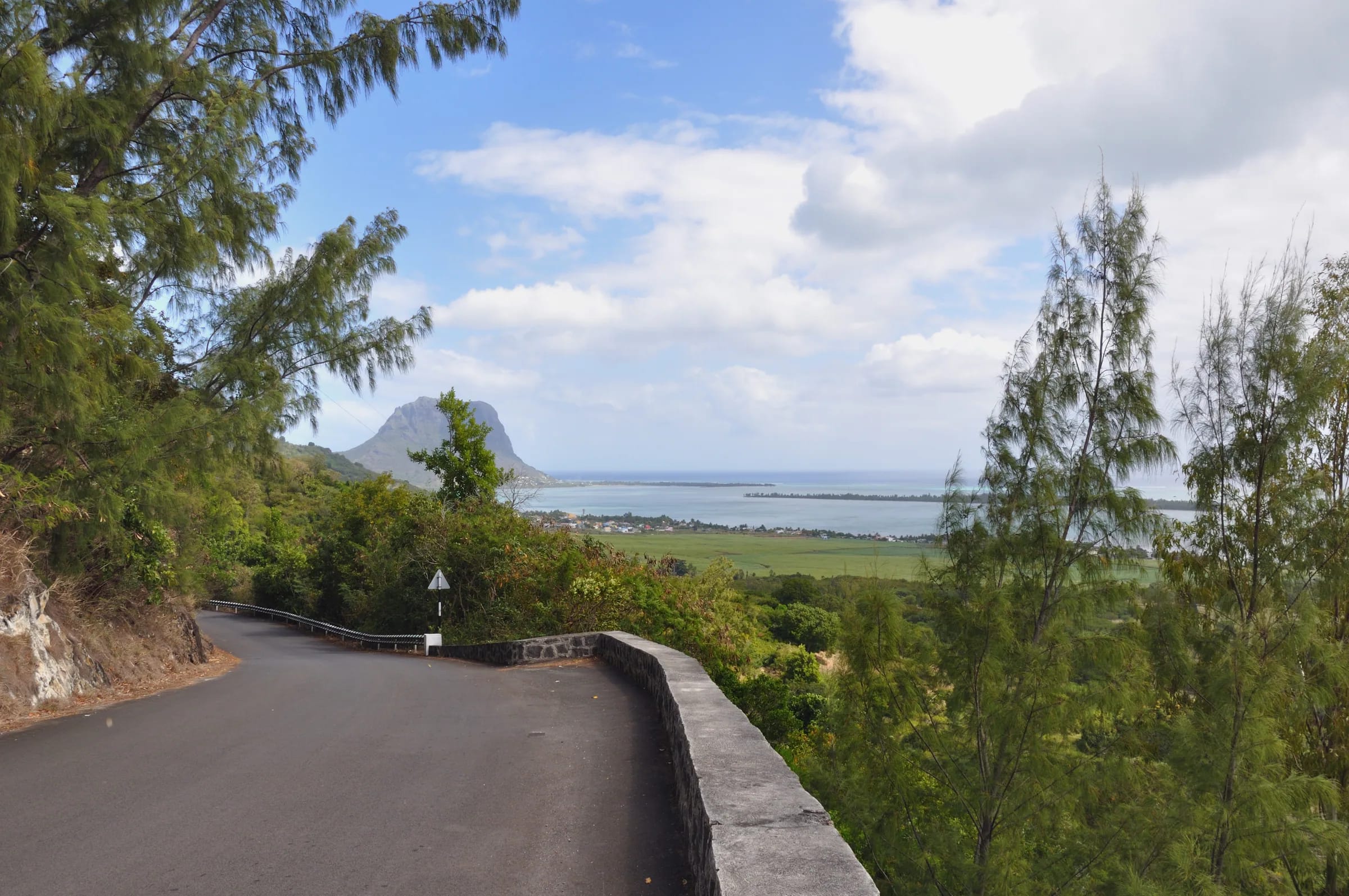
The Chamarel viewpoint is a free roadside lookout on the B104 hairpin road above Case Noyale, about 0.7 km from the centre of Chamarel village. It looks west and south-west over La Gaulette, the lagoon and Île aux Bénitiers to Le Morne Brabant, about 7 km away. There is no ticket, no opening time and no marked car park, so the stop is a careful pull-in on a bend, best made in the morning with the sun behind you. Many people search for it as Chamarel view point, and maps label it Viewpoint Chamarel, a name they also give to a second point higher up on the B103 plateau road.
Read the guide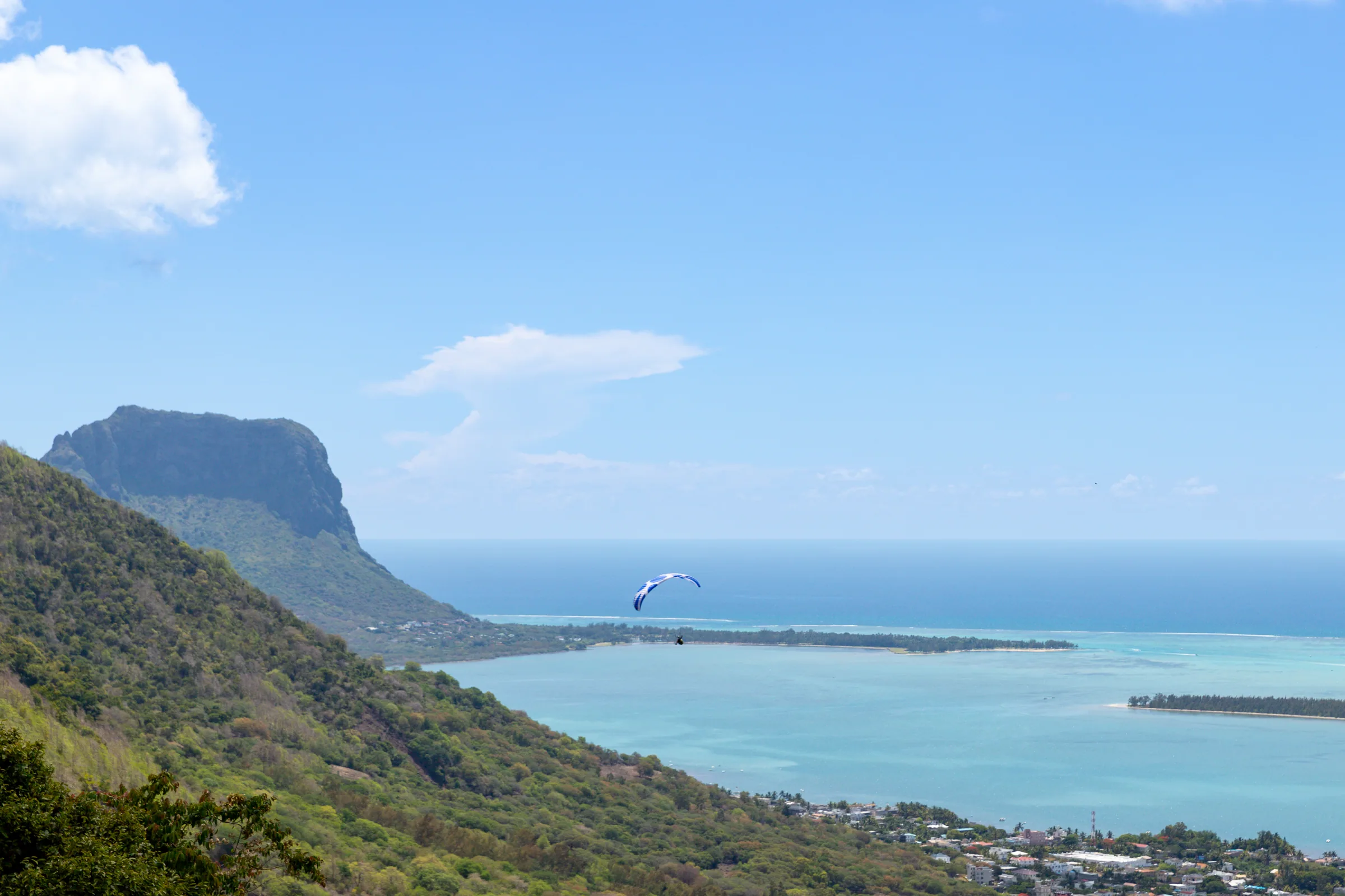
Where the Chamarel viewpoint is
The Chamarel viewpoint is on the B104 between Case Noyale and Chamarel, at -20.42120, 57.38641, about 0.7 km north-west of the village centre and about 100 m from Le Chamarel Restaurant.
Coming up from the coast, leave the B9 at Case Noyale and climb the hairpins, about 4 km and roughly 300 m of ascent. The viewpoint is on the right shortly before the village. From Le Morne the whole drive to Chamarel is about 14 km and 18 minutes, so the viewpoint comes roughly a quarter of an hour after leaving Le Morne. From the village it is the first stop on the way down towards Case Noyale. The Chamarel Seven Coloured Earth Geopark gate is about 2 km to the south in a straight line, so the viewpoint fits at the start or the end of a visit to the coloured earth and the waterfall.
What you see from the Chamarel viewpoint
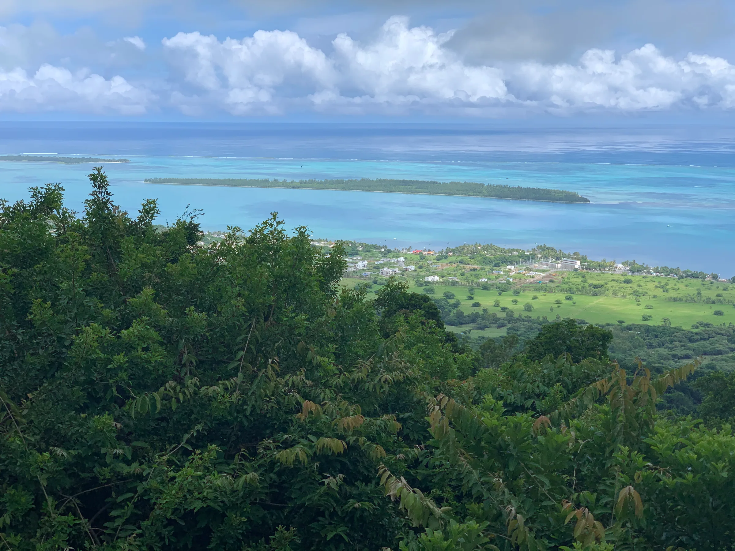
From the Chamarel viewpoint you look west and south-west down the slope to the coast at La Gaulette, across the lagoon to Île aux Bénitiers and along the shore to Le Morne Brabant, the 556 m basalt mountain on the peninsula at the south-west corner of Mauritius.
In a straight line, La Gaulette is about 2.9 km away, Île aux Bénitiers about 4.5 km due west and the summit of Le Morne about 7 km to the south-west. UNESCO inscribed Le Morne and its surroundings in 2008 as the Le Morne Cultural Landscape, for the maroons, enslaved people who escaped and hid on and around the mountain in the 18th and early 19th centuries. Chamarel itself, isolated on its hill, also sheltered maroons.
Similar views open from Sublime Point in Ebony Forest and from the top of Piton Canot, both of which look over Le Morne and Île aux Bénitiers, but the roadside viewpoint is the only one that is free and needs no walk.
Can you see Réunion from the Chamarel viewpoint?
Réunion is not visible from the Chamarel viewpoint on any normal day. The viewpoint faces the open sea to the west, the direction in which Réunion lies, and a sighting is possible only on an exceptionally clear day.
Do not make the trip for it. The view you can count on is Le Morne, Île aux Bénitiers and the lagoon, and on a clear morning that is reason enough to stop.
The best light at the Chamarel viewpoint
The best light at the Chamarel viewpoint is in the morning, when the sun is behind you in the east and falls on Le Morne and the lagoon from the front.
By late afternoon you look towards the sun, so Le Morne turns to a silhouette against the glare. Sunset falls between about 17:38 in June and 18:55 in January, and at about 18:12 in October, so a sunset stop on the way down means driving the rest of the hairpins at dusk. Haze and cloud vary from day to day, and the high ground behind you gets fewer hours of sunshine than the coast below.
Parking at the Chamarel viewpoint
The Chamarel viewpoint has no marked car park, so cars and coaches pull in along the roadside with their hazard lights on.
Some maps show a car park here. It is the widest pull-in, nothing more, so park fully off the carriageway, never on the bend itself. If the verge is full of coaches, carry on and stop on the way down instead, or take in the view from Le Chamarel Restaurant if you are eating there.
Safety on the bend
The Chamarel viewpoint sits on a hairpin road used by coaches and local traffic, so the care needed is in stopping, getting out and pulling away again.
- Get out on the verge side, keep children by the hand and stand well off the road for photographs.
- The corners on this road are slippery when wet, so pull away slowly after rain.
- Part of the B104 between Case Noyale and the village was rebuilt after a landslide closure from September 2021 to late 2022, and no roadworks are notified for 2025 or 2026.
- Lock the car and keep valuables out of sight, as at any roadside stop. There is no record of theft at the viewpoint.
- In an emergency, call the police on 999 or 112, the SAMU ambulance on 114 or the fire service on 115.
The second Viewpoint Chamarel on the plateau road
A second point carries the map name Viewpoint Chamarel. It sits on the B103 Plaine Champagne road beside the Varangue sur Morne restaurant, about 2.7 km east of the village centre and higher up the climb to the plateau.
The restaurant has an open veranda over the gorges. The roadside point beside it has no official page, so treat it as a short stop on the way up. The Black River Gorges viewpoint, about 1.3 km further east, is the bigger outlook, with a large free car park and a path of about 200 m to the rail.
Questions people ask
Where is the Chamarel viewpoint?
The Chamarel viewpoint is on the B104 hairpin road between Case Noyale and Chamarel village, on the right shortly before the village when you drive up from the coast. It is at -20.42120, 57.38641, about 0.7 km north-west of the village centre and about 100 m from Le Chamarel Restaurant. The climb from Case Noyale is about 4 km.
Is the Chamarel viewpoint free?
The Chamarel viewpoint is free and open at all hours, because it is a roadside lookout rather than a managed site, with no ticket, gate or attendant. The viewpoint is separate from the Chamarel Seven Coloured Earth Geopark, whose ticket costs Rs 800 for non-resident adults (checked on 29 October 2026) and is not needed for the viewpoint.
What can you see from the Chamarel viewpoint?
From the Chamarel viewpoint you see the coast at La Gaulette about 2.9 km away, the lagoon with Île aux Bénitiers about 4.5 km to the west, and Le Morne Brabant, the 556 m mountain at the heart of the UNESCO Le Morne Cultural Landscape, about 7 km to the south-west, all measured in a straight line. The view faces west and south-west over the sea.
Is there parking at the Chamarel viewpoint?
There is no marked car park at the Chamarel viewpoint. Cars and coaches stop along the roadside with their hazard lights on, and the car park shown on some maps is that same pull-in on a bend. Park fully off the road, never on the bend itself, and stop on the way down instead if the verge is full.
Can you see Réunion from the Chamarel viewpoint?
Réunion is not visible from the Chamarel viewpoint on any normal day. The viewpoint faces the open sea to the west, where Réunion lies, so a sighting is possible only on an exceptionally clear day, and it is no reason to make the trip. The view you can count on is Le Morne, Île aux Bénitiers and the lagoon.
When is the best time to visit the Chamarel viewpoint?
The best time to visit the Chamarel viewpoint is in the morning, when the sun is behind you and lights Le Morne Brabant and the lagoon from the front. In the late afternoon you look towards the sun. Sunset falls between about 17:38 in June and 18:55 in January, so a sunset stop means driving the hairpins down at dusk.
Is the Chamarel viewpoint the same as the Black River Gorges viewpoint?
No. The Chamarel viewpoint is on the B104 below the village and looks west over the lagoon to Le Morne, while the Black River Gorges viewpoint is on the B103 Plaine Champagne road about 4 km east of the village, at an entry point to the national park, and looks over the forested gorges. Both are free, and a third point by Varangue sur Morne is also mapped as Viewpoint Chamarel.
Go down to the mountain
The Chamarel and Le Morne page links the hill, the mountain and the lagoon below in one day.