
Chamarel weather and the best time to visit Mauritius
The best time to visit Mauritius for Chamarel is September to November, when the uplands get their least rain of the year, 101 to 126 mm a month in the South and Centre regions of the Mauritius Meteorological Services against up to 420 mm in February, and the west coast below is sunny and almost dry. Chamarel sits about 260 m up and 6 km inland and has no weather station of its own, so this guide reads it between the coastal station at Médine and the upland station at Vacoas. Expect the hill to be slightly cooler and wetter than the beaches, and the plateau above it cooler again. The waterfall is fullest from December to April, the months of heavy rain and cyclone warnings, so the right month depends on what you most want to see.
Read the guide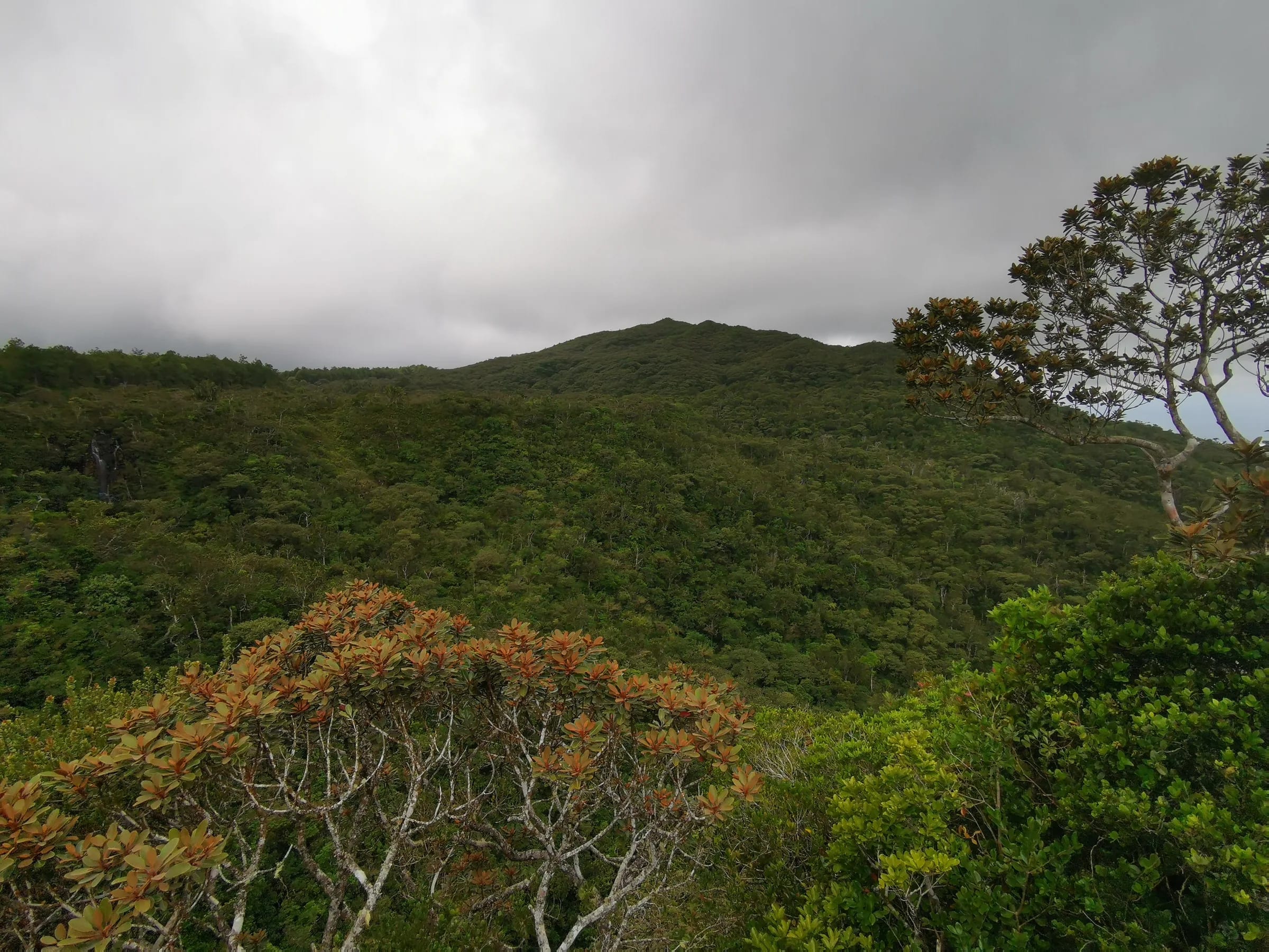
The best time to visit Mauritius for Chamarel is September to November
September to November is the best time to visit Chamarel because the south-west uplands are at their driest while the days are already warm. On the 1991 to 2020 averages of the Mauritius Meteorological Services (MMS), the Centre region receives 126 mm of rain in September, 106 mm in October and 116 mm in November, its three lowest months, against 420 mm in February. On the coast below, the MMS station at Médine records only two or three days of rain a month in this season and 7 to 8 hours of sunshine a day.
Only November falls inside the official cyclone season, which runs from 1 November to 15 May. The days are lengthening, with sunset moving from about 18:04 in September to 18:26 in November. The trade-off is Chamarel Waterfall, which runs at its thinnest in these months and can split into two narrow streams.
If you can choose only one month, choose October. The MMS names it the driest month in Mauritius, the 1991 to 2020 averages give it 73 mm of rain island-wide and 23 mm in the West region, and Médine still averages a daytime high of 27.8 °C. Come between December and April if a full waterfall matters more than clear skies, or from June to August if you want cool air on the trails of the Black River Gorges National Park and can accept showers on the plateau.
Mauritius weather by month, from the west coast to the uplands
The table gives the Mauritius weather by month at two Mauritius Meteorological Services (MMS) stations and for the rainfall regions on either side of Chamarel. There is no weather station in Chamarel itself, nor on the Plaine Champagne plateau above it. Médine, near the west coast, represents the MMS West region, and Vacoas, at about 425 m on the Central Plateau, represents the Centre region.
Read Chamarel between the columns. At about 260 m, the village is cooler than Médine and warmer than Vacoas, and its rain falls between the dry West, 920 mm a year, and the wet Centre, 2,739 mm a year. Rain days show the gap between the beaches and the hills most clearly. Médine averages two to ten a month, while Vacoas never records fewer than ten.
| Month | Médine, west coast, max / min °C | Vacoas, about 425 m, max / min °C | West region rain, mm | Centre region rain, mm | Rain days, Médine / Vacoas |
|---|---|---|---|---|---|
| January | 30.4 / 22.5 | 27.6 / 20.4 | 195 | 359 | 9 / 16 |
| February | 30.3 / 22.7 | 27.5 / 20.7 | 202 | 420 | 10 / 18 |
| March | 30.2 / 22.3 | 27.4 / 20.4 | 155 | 377 | 8 / 17 |
| April | 29.5 / 21.3 | 26.3 / 19.6 | 80 | 269 | 8 / 17 |
| May | 28.1 / 19.5 | 24.8 / 17.7 | 42 | 204 | 5 / 15 |
| June | 26.4 / 17.7 | 22.9 / 16.0 | 27 | 172 | 4 / 14 |
| July | 25.8 / 17.0 | 21.8 / 15.3 | 20 | 211 | 3 / 17 |
| August | 25.9 / 17.0 | 21.8 / 15.1 | 20 | 165 | 3 / 18 |
| September | 26.7 / 17.5 | 22.8 / 15.4 | 24 | 126 | 2 / 13 |
| October | 27.8 / 18.6 | 24.1 / 16.5 | 23 | 106 | 2 / 11 |
| November | 29.1 / 20.0 | 25.8 / 17.8 | 38 | 116 | 3 / 10 |
| December | 30.0 / 21.6 | 27.1 / 19.4 | 96 | 216 | 7 / 13 |
Summer, winter and the transition months in Mauritius
The Mauritius Meteorological Services (MMS) define a warm, humid summer from November to April, a relatively cool, dry winter from June to September, and May and October as transition months. The two seasons differ by only 4.3 °C on average, with the island at 24.7 °C in summer and 20.4 °C in winter, and about two thirds of its rain, 1,344 of 2,010 mm a year on the 1971 to 2000 averages, falls in summer, most of it in February and March.
Winter is dry on the beaches but not on the hill. From June to August the West region averages only 20 to 27 mm of rain a month, while the Centre region still receives 165 to 211 mm and Vacoas counts 14 to 18 rain days a month. A clear morning at Flic en Flac or Le Morne can turn to drizzle by the time you reach the Plaine Champagne road.
Daylight follows the seasons. Sunrise ranges from about 05:20 in late November to about 06:45 in July, and sunset from about 17:38 in June to 18:55 in January, which gives about 13 hours 20 minutes of daylight in December and under 11 hours in June. Mauritius keeps UTC+4 all year, with no daylight saving.
For the coming summer, the MMS outlook published on 27 October 2026 expects below-normal rain over Mauritius, about 1,100 mm or 80% of normal, with the first summer rains in the last week of November. The same outlook expects above-normal temperatures, with daytime highs of around 36 °C possible on the west coast, and warns that short, intense downpours may still cause local flash floods.
How much cooler Chamarel and the plateau are than the beaches
No station measures Chamarel or the plateau, but Vacoas, the Mauritius Meteorological Services (MMS) station at about 425 m, averages 3 to 4 °C cooler than Médine near the coast by day and about 2 °C cooler at night, and Chamarel at about 260 m and the plateau at 600 to 740 m sit below and above it in height.
On the coast, Médine’s average daytime high runs from 25.8 °C in July to 30.4 °C in January, and its average night from 17.0 °C in July and August to 22.7 °C in February. At Vacoas the highs run from 21.8 °C in July and August to 27.6 °C in January, and the nights from 15.1 °C in August to 20.7 °C in February.
Chamarel village falls between the two stations, a little cooler than the beaches at Le Morne or Flic en Flac. The Plaine Champagne road climbs to 740 m, about 300 m above Vacoas, so the plateau viewpoints are cooler again. The air turns cool and misty on the climb, and the plateau is markedly cooler than the coast, so carry an extra layer, most of all from June to September.
In summer the height works in your favour. On the hottest days on the coast, a few hours on the hill take you out of the worst of the heat.
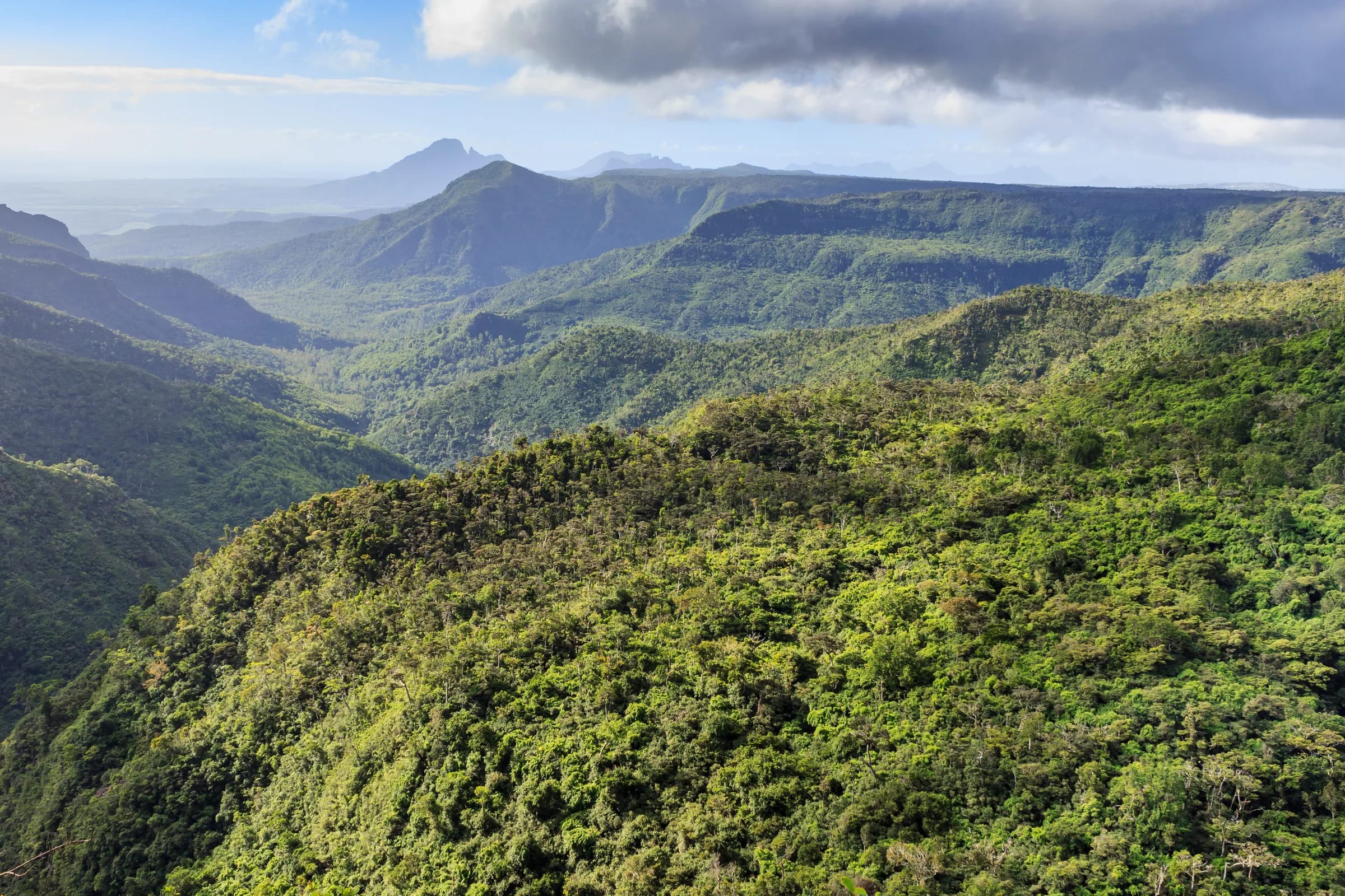
Does cloud build over the plateau in the afternoon?
Cloud builds over the plateau above Chamarel as the day warms. No weather station records the plateau by the hour, so the rule is to go up early.
What is measured is the overall difference between the high ground and the coast. The Mauritius Meteorological Services (MMS) climate summary gives the high ground about 6 hours of bright sunshine a day in summer and the Central Plateau about 5 hours in winter, against 7.5 to over 8 hours on the coast. No MMS station stands on the Plaine Champagne plateau, and the published normals do not break cloud down by hour.
Mist rises up the gorge at the Black River Gorges viewpoint and cloud sits on Plaine Champagne while Chamarel below stays clear. On a clear day the view is among the best in Mauritius, and rain arrives quickly from the interior, which is why the morning is the safer bet. Forecasts for the plateau also show fog at night and in the early morning on some days, with fairer afternoons, so a grey dawn does not settle the question.
Reach the viewpoints early, keep the sheltered stops for later in the day, and look at the plateau forecast for the day itself.
How the waterfall and the coloured earth look through the year
Chamarel Waterfall changes with the rain and the Seven Coloured Earth changes with the light, so the two sights look their best in different seasons.
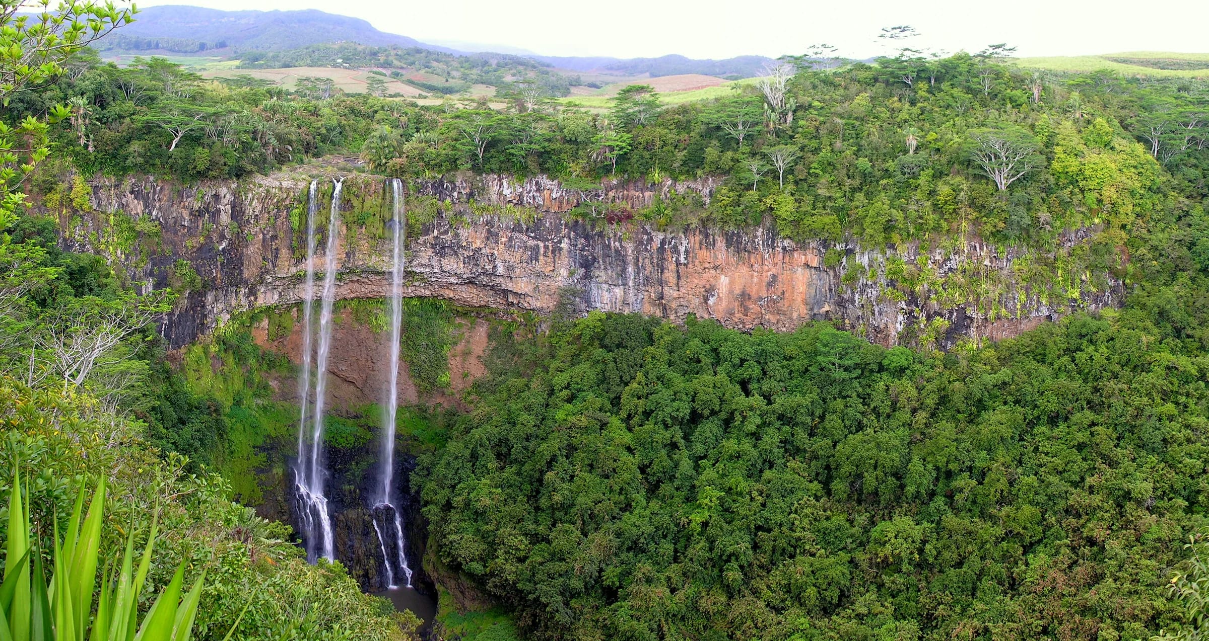
Chamarel Waterfall, a single drop of about 95 to 100 m (83 m in some records), is fullest from December to March or April, after the summer rains. In the drier months it thins and can split into two narrow streams, most likely from September to November, when the uplands get the least rain. The fall has never been recorded running dry, but summers vary, and it ran low even in January 2013. If the drier summer forecast for 2026 to 2027 proves right, expect less water than usual this season.
The Seven Coloured Earth, inside the Chamarel 7 Coloured Earth Geopark, depends on sunshine far more than on the month. Its bands of red, brown and violet read best in direct sun, especially when the sun returns after rain, and under a grey sky they flatten and can look muddy. The dunes cover only about 7,500 m² and look smaller than the photographs, most of all on a dull day. Morning is the safer bet for the light, before the hills cast their shadow over the dunes; the geopark itself suggests mornings or late afternoons.
The geopark opens at 08:30 every day and closes at 17:30 from October to May and at 17:00 from June to September (checked on 29 October 2026), so sunrise and sunset light are out of reach. For the trails of the Black River Gorges National Park, May to November is the season, when the paths are drier. Summer showers come suddenly and turn them to mud.
Cyclone season runs from 1 November to 15 May
The Mauritius Meteorological Services (MMS) set the official cyclone season from 1 November to 15 May, and their outlook of 27 October 2026 expects five to seven named storms in the South-West Indian Ocean this season, not necessarily affecting Mauritius directly. The MMS station tables for Médine and Vacoas show no gust of 120 km/h or more outside the months from December to April, and the recent Class III warnings for Belal in January 2024 and Garance in February 2025, both of which closed the airport, fell in the same months. The Chamarel 7 Coloured Earth Geopark closes during cyclones and heavy rainfall, so keep a spare day if you travel in summer. The cyclone season page of this guide explains the four warning classes, what closes on the hill and the landslide repairs that shut the Case Noyale road in 2021 and 2022.
Check the day itself before you drive up
Monthly averages help you choose when to travel, but conditions on the plateau change within hours, so check the day itself before you drive up to Chamarel.
The live board below reads today’s forecast for Chamarel village and for the plateau at the Black River Gorges viewpoint, gives the clearest window for the viewpoints when the forecast shows one, and estimates the flow of Chamarel Waterfall from modelled rain over its catchment in the past 7 and 30 days. That flow figure is an estimate, not a gauge reading. The board also counts the sights open right now and shows any closure notice in force.
If the plateau is clouded in, start with the village, the Chamarel 7 Coloured Earth Geopark and the Rhumerie de Chamarel, which lie well below it at about 260 to 300 m, and try the viewpoints later. In a cyclone warning or a torrential rain warning, read the bulletins of the Mauritius Meteorological Services before setting out.
A wet day on the plateau
Heavy rain, storms or strong gusts are forecast. The hairpin road is slower in rain, the viewpoints will show little and the waterfall path turns to mud. The geopark, the rhumerie and Curious Mauritius still work in rain.
No closure notice
Questions people ask
What is the best time to visit Mauritius?
The best time to visit Mauritius for a mix of beaches and hill country such as Chamarel is September to November. October is the driest month in Mauritius on the Mauritius Meteorological Services record, the uplands get their least rain of the year and the west coast averages only two or three rainy days a month. December to April brings Chamarel Waterfall at its fullest but also the heaviest rain and the cyclone warnings, while June to August is cool and dry on the coast but showery on the plateau.
What is the rainy season in Mauritius?
The rainy season in Mauritius is the summer, from November to April, when the island receives about two thirds of its annual rain, 1,344 of 2,010 mm on the 1971 to 2000 averages of the Mauritius Meteorological Services. February and March are the wettest months. The uplands get far more than the coast, with an average February bringing 420 mm to the Centre region against 202 mm in the West, and around Chamarel the plateau stays showery into winter.
Is October a good time to visit Mauritius?
Yes. October is the driest month of the year in Mauritius, with 73 mm of rain island-wide and 23 mm in the West region on Mauritius Meteorological Services averages, and coastal highs of about 28 °C. For Chamarel it is close to ideal, since the uplands also get their least rain, the sun rises at about 05:40 and sets at about 18:10, and the cyclone season only opens on 1 November. The one drawback is a thin waterfall.
What is the worst time to visit Mauritius?
The worst time to visit Mauritius for a day in Chamarel is January to March. These are the wettest months, with an average February bringing 420 mm of rain to the Centre region and 323 mm island-wide, the high ground gets fewer hours of sunshine than the coast, and the recent Class III cyclone warnings for Belal in January 2024 and Garance in February 2025 both fell in this window. The waterfall is fullest then, so it is a trade-off rather than a lost season.
What is the weather like in Mauritius in May?
May is a transition month in Mauritius, cooling from summer towards winter, and the official cyclone season runs until 15 May. At Médine on the west coast, days average 28.1 °C and nights 19.5 °C with about five days of rain, while the West region averages 42 mm and the Centre region 204 mm, so expect showers on the plateau above Chamarel. The Chinese guava season from 15 April to 15 May brings heavy traffic to the Plaine Champagne road.
What is the weather like in Chamarel?
Chamarel is warm all year and slightly cooler and wetter than the beaches below, because the village sits about 260 m up on the edge of the south-west uplands. There is no weather station in the village. The Mauritius Meteorological Services stations either side, Médine near the coast and Vacoas at about 425 m, average daytime highs of 25.8 to 30.4 °C and 21.8 to 27.6 °C through the year, and Chamarel falls between them.
Is Chamarel Waterfall flowing in October?
Yes. Chamarel Waterfall flows all year and has never been recorded dry, but October is one of its lowest months. The fall is fullest from December to March or April, and in the dry season it thins and can split into two narrow streams. October brings the least rain of the year to the uplands, 106 mm in the Centre region against 420 mm in February, so expect a slender fall rather than a full curtain of water.
What time of day is best for Chamarel?
Morning is the best time of day for Chamarel. The walkway is quiet at the 08:30 opening of the Chamarel 7 Coloured Earth Geopark (checked on 29 October 2026), the coaches arrive from late morning, and rain and cloud come in from the interior later in the day. The coloured earth needs sunshine more than a particular hour, so on a grey morning it can pay to wait for the sun.
Build the day around the light
The day plan gives the order that beats the crowds and the cloud, with half-day and full-day versions.