
Black River Gorges National Park from the Chamarel side
The Black River Gorges National Park, the largest national park in Mauritius at about 67.5 km², is free to enter (checked on 29 October 2026), and from Chamarel its nearest door is the Gorges viewpoint on the Plaine Champagne road (B103), about 4 km east of the village as the crow flies. The viewpoint has free parking and toilets, Black River Peak starts about 350 m along the road, and the long trails begin at Le Pétrin and at the Black River visitor centre. The park publishes no official hours and the gate times in circulation disagree, so plan to be back at the car by 17:00.
Read the guide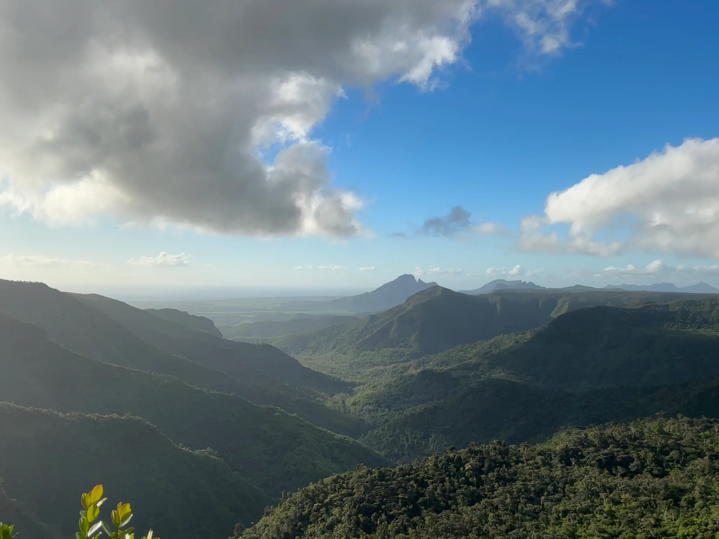
What the Black River Gorges National Park is
The Black River Gorges National Park is the largest national park in Mauritius, a protected area in the hilly south-west that holds most of the remaining rainforest in the country and runs from the plateau above Chamarel towards the west coast at Rivière Noire.
The park was proclaimed on 15 June 1994 and is managed by the National Parks and Conservation Service. Its area is recorded as 67.54 km² and as 6,574 ha, a gap of 180 ha that no official page settles. Inside are humid upland forest, drier lowland forest and marshy heathland, about 60 km of trails, two information centres and picnic areas.
From Chamarel the Plaine Champagne road (B103) climbs east into the park, past the Black River Peak trailhead, the Gorges viewpoint and Alexandra Falls, to Le Pétrin. The longer trails start at the Pétrin information centre and at the Black River visitor centre.
Is the Black River Gorges National Park free, and when is it open?
Entry to the Black River Gorges National Park is free, with no ticket or booking, and the park publishes no opening hours of its own; the gate times in circulation disagree (both checked on 29 October 2026).
The National Parks and Conservation Service publishes no fees or hours online. The ‘trail fees’ above Rs 1,000 advertised online are private guiding rates. Parking at the Gorges viewpoint is free, and a trail map costs a few rupees to a few dozen rupees at the information centres (checked on 29 October 2026).
The gate times in circulation are 07:00 to 17:00 on weekdays and 09:00 to 17:00 at weekends in a May 2024 record, and 06:00 to 18:00 daily, weather permitting, in a March 2026 record. Barriers close on the hour and can shut a car in. Be back at your car before 17:00, or call the park service on +230 464 4053 when timing matters. The barriers are at the gated entrances. The Gorges viewpoint is a car park directly off the public B103, and no barrier there is on record.
The Black River Gorges viewpoint on the Chamarel road
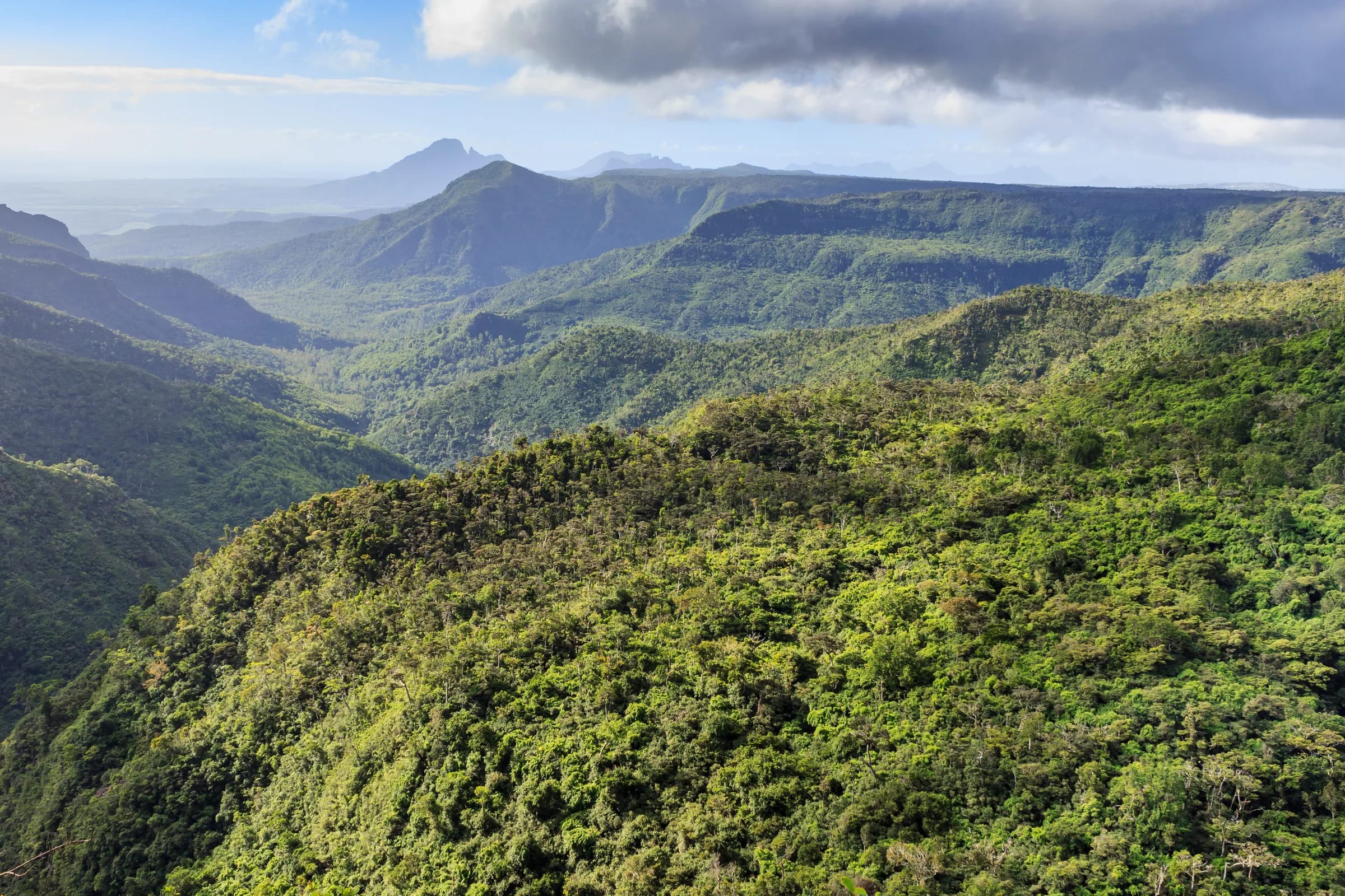
The Black River Gorges viewpoint is a roadside lookout with free parking on the Plaine Champagne road (B103), at -20.42299, 57.42962, about 4 km east of Chamarel village as the crow flies (checked on 29 October 2026).
There are two free paved car parks with room for coaches, a gentle path of about 200 m to the railing, free toilets, and stalls selling souvenirs and refreshments (checked on 29 October 2026). The platform looks down into the forested gorge, and a waterfall is visible from it. The Trochetia trail, which leaves from the northern end of the viewpoint, crosses the stream that feeds that waterfall.
No altitude is published for the viewpoint itself. The Trochetia trail beside it runs between about 654 and 707 m and the Black River Peak trailhead, about 350 m west, is at 682 m, which puts the lookout at roughly 650 to 700 m.
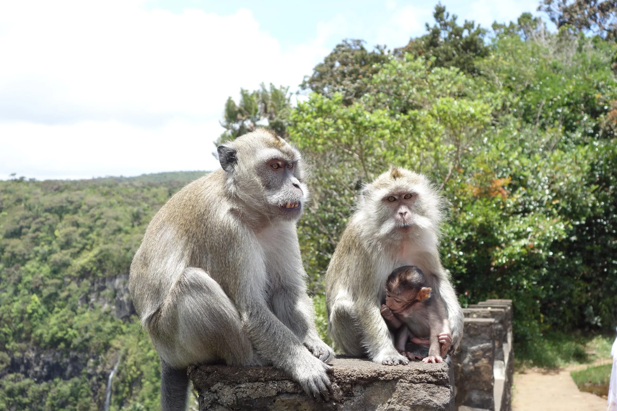
Long-tailed macaques work the car park and the railing and raid bags, so keep food sealed and car windows closed.
How often is the Black River Gorges viewpoint in cloud?
No official record counts how often the Black River Gorges viewpoint is in cloud. The lookout sits at the height where cloud forms over the plateau, so the forecast for the day you go is the best guide.
The Mauritius Meteorological Services record about 6.0 hours of sunshine a day over high ground in summer and about 5.0 hours on the Central Plateau in winter, against 7.5 to more than 8 hours on the coast. Cloud bases over the Plaine Champagne road sit between about 450 and 950 m, the band the viewpoint stands in, while Chamarel village is at about 260 m. That is how the gorge fills with mist while the village below is in sunshine.
Mist rises up the gorge like slow water, and the viewpoint can sit in cloud while the village below is in sun. Cloud builds over the plateau as the day warms and rain arrives quickly from the interior, so go up early, and if the cloud is patchy, wait a few minutes at the railing before giving up.
The live board below reads the hourly forecast for the plateau and shows whether the Gorges and Alexandra Falls viewpoints are likely to be clear, partly clouded or clouded in, with the clearest window of the day when there is one. It is a forecast, not a camera.
Today in Chamarel
Today’s conditions are unavailable right now. Check the Mauritius Meteorological Services before you go.
No closure notice
Today’s conditions are unavailable right now. Check the Mauritius Meteorological Services before you go. Check the official forecast
The Pétrin and Black River entrances
Besides the roadside viewpoint, the Black River Gorges National Park has two information centres that serve as entrances and trailheads, Pétrin on the plateau in the east and Black River near the west coast.
The Pétrin information centre is at -20.40848, 57.47178, at the eastern end of the Plaine Champagne road near its junction with the B102 and the B88 to Grand Bassin, with toilets behind it, and the Macchabée trail starts here. Its hours as recorded in March 2026 are 07:00 to 15:00 on weekdays and until 17:00 on Saturdays, closed on Sundays; an older record gives shorter weekend hours. The park service lists +230 464 4053 for it.
The Black River visitor centre is near sea level at -20.38355, 57.42165, reached by the B114 Les Gorges Road from the coast at Rivière Noire, with toilets beside it. The Parakeet and Mare aux Joncs trails start on this side. Its hours are 09:00 to 15:00 on weekdays and 09:00 to 16:00 at weekends, from an undated record (checked on 29 October 2026). From Chamarel the road route goes down to Case Noyale and north along the coast.
The main Black River Gorges trails
The main Black River Gorges trails run from a 200 m stroll at the Gorges viewpoint to a long descent from Le Pétrin to the west coast. Distances and times vary with the version walked, so the table gives the range for each.
All the trails are free and unguided, signage is sparse in places and mobile signal is patchy deeper in the forest. A one-way walk such as Pétrin to Black River needs a car at the bottom and a start before 09:00, so that you are out before the gates can close at 17:00 (checked on 29 October 2026).
| Trail | Starts at | Distance | Time | What to expect |
|---|---|---|---|---|
| Viewpoint path | Gorges viewpoint, B103 | About 200 m | A short stroll | Gentle slope |
| Trochetia trail | North end of the viewpoint | 1.8 km one way | About 30 min one way | One sign only |
| Black River Peak | B103, 350 m west of the viewpoint | 6.25 to 7 km return | 2 to 4 h | Mud, ropes near the top |
| Alexandra Falls | B103, 3 km east of the viewpoint | About 240 m, or a 2.75 km loop | 3 min, or 1 h 10 for the loop | Loop very steep and rocky |
| Macchabée | Pétrin information centre | 8.9 to 10 km one way | 2 to 3 h, up to 7 h for the full descent | Long descent, car needed at the end |
| Parakeet | Black River visitor centre or the B103 | 6.5 to 8 km one way | 1.5 to 2 h one way, 7 h 30 in one record | Sustained climb, slippery crossing |
Birds, bats, deer and macaques in the park
The Black River Gorges National Park shelters all of the endemic birds of Mauritius and the Mauritian flying fox, alongside introduced rusa deer and wild pigs, and long-tailed macaques that gather at the roadside viewpoints.
The park holds eight endemic birds, the Mauritius kestrel, the pink pigeon, the echo parakeet (also called the Mauritius parakeet), the Mauritius cuckooshrike, the Mauritius bulbul, the Mauritius olive white-eye, the Mauritius grey white-eye and the Mauritius fody, in a forest degraded by Chinese guava and privet. None is guaranteed, and the nature and wildlife page sets out where each is most often seen.
The macaques are the animals most visitors meet, at the Gorges viewpoint car park, at Alexandra Falls, where signs prohibit feeding, and on the Black River Peak path. Do not feed them, keep food sealed and never leave a bag open or a car window down.
What to carry and when to go
Carry water, a warm layer and a rain jacket, wear shoes with real grip and download an offline map, because the Black River Gorges National Park is cooler, wetter and less connected than the coast below.
The best months are May to November, or April to October at the widest, with starts before 09:00. Cyclone season runs roughly November to April, with warnings possible until mid May. In an emergency call the police on 999 (112 also works), the SAMU ambulance on 114 or the fire service on 115.
- Water and food. No drinking water is provided on the trails, and refreshments are sold only at the Gorges viewpoint and Alexandra Falls car parks.
- A warm layer. The plateau is markedly cooler than the coast, and a winter day at the road summit can top out at 19 °C.
- Grip and a rain jacket. Paths turn muddy and slippery after rain, and summer showers arrive suddenly.
- Fuel. There is no fuel station in Chamarel, so fill up in Black River or Tamarin first.
Questions people ask
Is there an entry fee for Black River Gorges National Park?
Entry to the Black River Gorges National Park is free, with no ticket or booking (checked on 29 October 2026). Parking at the Gorges viewpoint is free too. The ‘trail fees’ of more than Rs 1,000 advertised online are private guiding rates, not a park charge. The only small cost is a trail map sold at the information centres, from Rs 5 to a few dozen rupees.
What time does Black River Gorges National Park open?
The park service publishes no opening hours, and the gate times in circulation disagree (checked on 29 October 2026). A May 2024 record gives 07:00 to 17:00 on weekdays and 09:00 to 17:00 at weekends, with barriers that close on the hour. A March 2026 record gives 06:00 to 18:00 daily, weather permitting. Plan to be back at your car before 17:00.
Where do you park for the Black River Gorges viewpoint?
The Black River Gorges viewpoint has two free paved car parks directly off the Plaine Champagne road (B103), including coach parking, with free toilets and a gentle path of about 200 m to the railing (checked on 29 October 2026). The car park is about 4 km east of Chamarel village as the crow flies and about 350 m east of the Black River Peak trailhead. Keep food out of sight, because macaques patrol the car park.
Are there monkeys at Black River Gorges?
Yes, long-tailed macaques live around the Black River Gorges National Park and are met most often at the Gorges viewpoint car park, at Alexandra Falls and on the Black River Peak path. The macaques are an introduced species, not native, and they take food from bags. Do not feed them, keep food sealed and out of sight, and keep car windows closed when you walk away.
How long do you need at Black River Gorges?
A visit to the Black River Gorges viewpoint can be a short stop from the car park, while the trails take from 30 minutes to a full day. The Trochetia trail from the viewpoint takes about 30 minutes each way, Black River Peak 2 to 4 hours return, and Macchabée 2 to 3 hours on the track from Le Pétrin to the viewpoint, or as much as 7 hours for the full descent to the west coast.
What is the best time to visit the Black River Gorges viewpoint?
Morning is the best time to visit the Black River Gorges viewpoint. Cloud builds over the plateau as the day warms, and rain arrives quickly from the interior. The drier months, roughly May to November, give the clearest days. Check the forecast for the plateau before you drive up, and if the cloud is patchy, wait a few minutes at the railing.
Can you drive through the Black River Gorges National Park?
The Plaine Champagne road (B103) crosses the upper Black River Gorges National Park from Chamarel to Le Pétrin, passing the Black River Peak trailhead, the Gorges viewpoint and Alexandra Falls, and continues towards Grand Bassin. The Black River visitor centre on the west side is reached separately, by the B114 from the coast road at Rivière Noire. Walkers link the two sides on the Macchabée and Parakeet trails.
Choose a trail
The hiking page compares Macchabée, Parakeet, Black River Peak and the plateau walks, with start points, distances and honest grades.