
Cyclone season in Mauritius and what it means for Chamarel
The Mauritius Meteorological Services (MMS) set the official cyclone season in Mauritius from 1 November to 15 May, and their outlook of 27 October 2026 expects five to seven named storms in the South-West Indian Ocean this season while stressing that they will not necessarily affect the island directly. Warnings come in four classes, from Class I, issued 36 to 48 hours before gusts of 120 km/h are expected, to Class IV, when such gusts are blowing. Around Chamarel, the Chamarel 7 Coloured Earth Geopark closes during cyclones and heavy rainfall, and the hill road from Case Noyale was closed for about a year in 2021 and 2022 for landslide repairs.
Read the guide
When is cyclone season in Mauritius?
Cyclone season in Mauritius officially runs from 1 November to 15 May, the dates the Mauritius Meteorological Services (MMS) give in their summer outlook of 27 October 2026. Other dates circulate because two calendars are in use. The wider South-West Indian Ocean basin counts its season from 15 November to 30 April, with Mauritius and the Seychelles keeping 15 May as their end date, and the combined span of 15 November to 15 May also circulates.
The calendar is a convention, not a guarantee. Storms can form outside it, and one, Moderate Tropical Storm Agueda, had already been named by the Madagascar weather service on 20 October 2026, before the season opened. For visitors, what matters more is when warnings have actually come, and the Class III warnings for Belal and Garance, covered below, came in January 2024 and February 2025.
For 2026 to 2027 the MMS outlook also expects a hotter, drier summer than normal over Mauritius, with about 80% of normal rain, but warns that short bursts of intense rain may still cause local flash floods.
What the four cyclone warning classes mean for visitors
Mauritius has four cyclone warning classes, each defined by how close gusts of 120 km/h are, and each one changes what a visitor can sensibly do. The Mauritius Meteorological Services (MMS) issue them for any tropical depression, storm or cyclone likely to affect Mauritius or Rodrigues, and publish the bulletins in English, French and Creole.
Two further bulletins end a warning. A safety bulletin lifts Class III or IV once the risk of cyclonic gusts has eased and the storm is moving away, and it can still report severe weather. A termination bulletin, issued after consultation with the National Crisis Committee, ends the episode once outdoor risks have considerably decreased. Until the all-clear, the MMS advises people not to leave their shelter.
| Class | When the MMS issues it | What it means for a visitor |
|---|---|---|
| Class I | 36 to 48 hours before gusts of 120 km/h are expected | Plans can still run, but move a Chamarel day if timing is tight. The MMS asks people to ready an emergency kit and follow the radio and TV bulletins. |
| Class II | With, as far as practicable, about 12 hours of daylight left before gusts of 120 km/h | Not a day for the hill road. Return to your accommodation, store drinking water and keep following the bulletins. |
| Class III | With, as far as practicable, about 6 hours of daylight left before gusts of 120 km/h | Stay where you are staying. The MMS advises completing all preparations, securing vehicles, avoiding areas prone to flooding and avoiding going outside. |
| Class IV | When gusts of 120 km/h are recorded in some places and expected to continue | Stay inside, in the safest part of the building. A calm spell may be the eye, which the MMS warns is followed by violent winds from the opposite direction. |
Heavy rain can close Chamarel without a cyclone
Heavy rain alone closes the Chamarel 7 Coloured Earth Geopark, the village’s main sight, which shuts during heavy rainfall as well as during cyclones. The Mauritius Meteorological Services (MMS) issue a separate torrential rain warning when rainfall in a region has reached 100 mm, or is likely to within the next hour, and more rain is expected.
Rain matters more on the hill than on the beach. The MMS lists the hazards as flash floods, rivers overflowing downstream, sometimes where it is not raining heavily, and landslides on hill and mountain slopes, and Chamarel has the terrain for all three. The village sits at about 260 m on steep ground, its waterfall drops into a gorge, and the B104 climbs from Case Noyale between mountain cuttings and ravines.
In heavy rain, keep away from rivers and gorges, leave the guided descent to the base of Chamarel Waterfall for another day and expect the hairpin bends to be slippery.
What closes around Chamarel during a cyclone
The Chamarel 7 Coloured Earth Geopark, which holds the coloured earth and both waterfall viewpoints, closes during cyclones and heavy rainfall. Its normal hours are 08:30 to 17:30 from October to May and 08:30 to 17:00 from June to September, every day including Sundays and public holidays (checked on 29 October 2026).
The Rhumerie de Chamarel, Ebony Forest, the village restaurants and the Black River Gorges National Park publish no cyclone policy, and the national park is open weather permitting. Expect them all to follow the warnings, and phone before setting out once a warning has been lifted.
Beyond the hill, recent storms closed the essentials. On 15 January 2024, the day Belal brought a Class III warning, Sir Seewoosagur Ramgoolam International Airport, government offices and schools were all closed, and during Garance in February 2025 the airport closed temporarily and schools shut for two days. A cyclone can therefore cost a day at either end of a holiday as well as a day of sightseeing.
The landslide closure of the Case Noyale road in 2021 and 2022
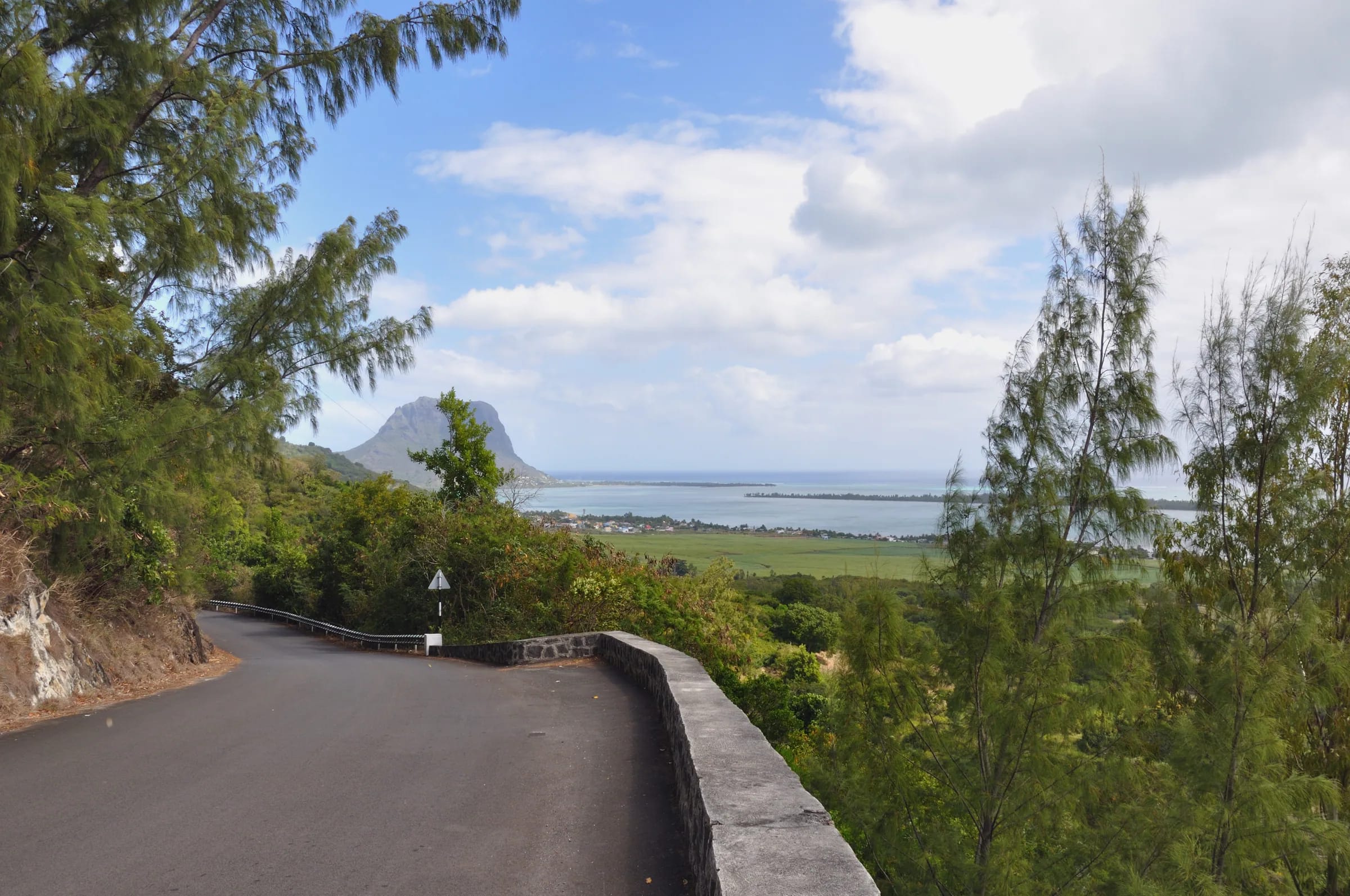
The B104 between Case Noyale and Chamarel, the hairpin road up from the west coast, was closed to traffic in both directions from September 2021 for landslide and slope-stability works by Sinohydro Corporation (Mauritius) Ltd, which were due to finish at the end of August 2022. During a site visit, the minister pointed to steep mountain cuttings on one side, deep ravines on the other and bad weather as causes of delay.
Prime Minister Pravind Kumar Jugnauth inaugurated the rebuilt 1.4 km section shortly before 3 December 2022 and said the road had been closed for a whole year. No cyclone or single storm is on record as the cause of the original damage.
The episode shows how long one stretch of hill road can be lost. If the B104 from Case Noyale is closed again, Chamarel can still be reached by the Plaine Champagne road (B103) from the Grand Bassin and Le Pétrin side, or by the B104 from Baie du Cap in the south, both longer drives from the west coast.
Recent cyclones in Mauritius and what they did to Chamarel
Neither Cyclone Belal in January 2024 nor Cyclone Garance in February 2025 left any recorded damage or closure in Chamarel, the Rivière Noire district or on the Plaine Champagne plateau. Both storms did their worst elsewhere.
Belal put Mauritius under a Class I warning on 13 January 2024, and the Mauritius Meteorological Services (MMS) raised it to Class III on 15 January. That day torrential rain turned streets in Port Louis into rivers and swept away vehicles, a motorcyclist died in floodwater at Les Pailles, and local economists later estimated the damage at Rs 5.8 billion. The government said the MMS had not given enough warning and had underestimated the storm, and the service’s director was dismissed with effect from 17 January, pending an internal investigation.
Garance brought a Class III warning on 26 February 2025. The airport closed temporarily, schools shut for two days and heavy-swell warnings for waves of 5 to 7 m in the open sea raised the risk of coastal flooding, particularly on the north and west coasts. Most of the deaths and damage were in neighbouring Réunion.
The 2025 to 2026 season brought no landfall on Mauritius. Cyclone Dudzai passed about 300 km to the south-east in January 2026 and sent swell onto the coast.
How to plan a Chamarel day in cyclone season
A Chamarel day between November and May needs slack in the plan and a habit of checking the official bulletins, because a cyclone warning or a day of torrential rain can close the geopark at short notice.
- Put Chamarel early in your stay and keep a spare day, so that a warning moves the visit rather than cancels it.
- Check the Mauritius Meteorological Services bulletins on the morning you go. A Class II warning means gusts of 120 km/h may arrive within about 12 hours of daylight, which is not the day for a hill road.
- After a warning is lifted, phone the Chamarel 7 Coloured Earth Geopark on +230 483 4298 before driving up, and watch for fallen trees, power lines and flooded watercourses, which the MMS lists among the dangers after a cyclone.
- Leave a buffer before your flight home, since the airport closed during both Belal and Garance.
- Save the emergency numbers in your phone. Call 999 or 112 for the police, 114 for the SAMU ambulance and 115 for the fire service.
Where to follow official cyclone warnings
The Mauritius Meteorological Services (MMS) issue the official cyclone warnings for Mauritius, and their website, metservice.intnet.mu, carries the current cyclone bulletin in English, French and Creole, together with the torrential rain, heavy swell and special weather bulletins.
The MMS precautions tell the public to follow the cyclone bulletins on radio and television, and the service says its torrential rain warnings are broadcast on the MBC and private radio stations. Act on the bulletin itself rather than on second-hand reports, and wait for the all-clear before going out after a Class III or IV warning.
Questions people ask
When is cyclone season in Mauritius?
Cyclone season in Mauritius officially runs from 1 November to 15 May, the dates set by the Mauritius Meteorological Services in their summer outlook of 27 October 2026. The wider South-West Indian Ocean basin uses 15 November to 30 April, which is why 15 November also circulates as the start. The recent Class III warnings for Mauritius came in January 2024 for Belal and February 2025 for Garance.
What do the cyclone warning classes mean in Mauritius?
Mauritius has four cyclone warning classes, all keyed to gusts of 120 km/h. Class I is issued 36 to 48 hours before such gusts are expected, Class II when about 12 hours of daylight remain, Class III when about 6 hours of daylight remain, and Class IV when the gusts are blowing and expected to continue. A safety bulletin lifts Class III or IV, and a termination bulletin ends the episode.
Is it safe to visit Mauritius during cyclone season?
No one can promise a storm-free trip between November and May, but a warning is not certain in any given season. The 2025 to 2026 season brought no landfall on Mauritius, while Belal in 2024 and Garance in 2025 both brought Class III warnings and closed the airport. For 2026 to 2027 the Mauritius Meteorological Services expect five to seven named storms across the basin, not necessarily near Mauritius. Keep plans flexible and follow the official bulletins.
Does the Seven Coloured Earth close during cyclones?
Yes. The Chamarel 7 Coloured Earth Geopark, which includes the Seven Coloured Earth and the Chamarel Waterfall viewpoints, is open all year except during cyclones and heavy rainfall (checked on 29 October 2026). After a warning is lifted, phone the geopark on +230 483 4298 before driving up to confirm that it has reopened.
Was Chamarel damaged by Cyclone Belal?
Cyclone Belal in January 2024 left no recorded damage or closure in Chamarel, the Rivière Noire district or on the Plaine Champagne plateau. Its worst effects were in Port Louis, where torrential rain flooded streets and a motorcyclist died at Les Pailles, with damage across Mauritius estimated at Rs 5.8 billion.
Can you visit Chamarel in heavy rain?
Chamarel can be visited in ordinary showers, and the Rhumerie de Chamarel has sheltered visits and Curious Mauritius includes indoor rooms and covered outdoor spaces, but the Chamarel 7 Coloured Earth Geopark closes in heavy rainfall and cyclones. When the Mauritius Meteorological Services issue a torrential rain warning, meaning 100 mm of rain has fallen in a region or is about to, stay off the hill road and away from rivers and gorges, and leave the waterfall for another day.
How did the 2021 landslide affect the road to Chamarel?
The B104 between Case Noyale and Chamarel was closed in both directions from September 2021 for landslide and slope-stability works, due to end in August 2022, and the Prime Minister said at the reopening that the road had been closed for a whole year. A rebuilt 1.4 km section now carries traffic. The other approaches, the Plaine Champagne road from the plateau and the road from Baie du Cap, are longer from the west coast.
See the weather month by month
The weather page sets the cyclone months against the rain, temperatures and light on the hill, with a live board for the day itself.