
The Chamarel Waterfall hike to the base of the fall
The Chamarel Waterfall hike is a guided descent from the Chamarel Seven Coloured Earth Geopark to the pool at the foot of the 83 to 100 m fall, sold as an outing of about 3 hours, because the geopark strictly prohibits going down on your own. The descent itself takes about 45 minutes on a forest path that is slippery in places and meant for experienced walkers. Neither the geopark nor the guides publish where the path starts, how long it is or whose land it crosses, so this page sets out what is known and what to ask before you go.
Read the guide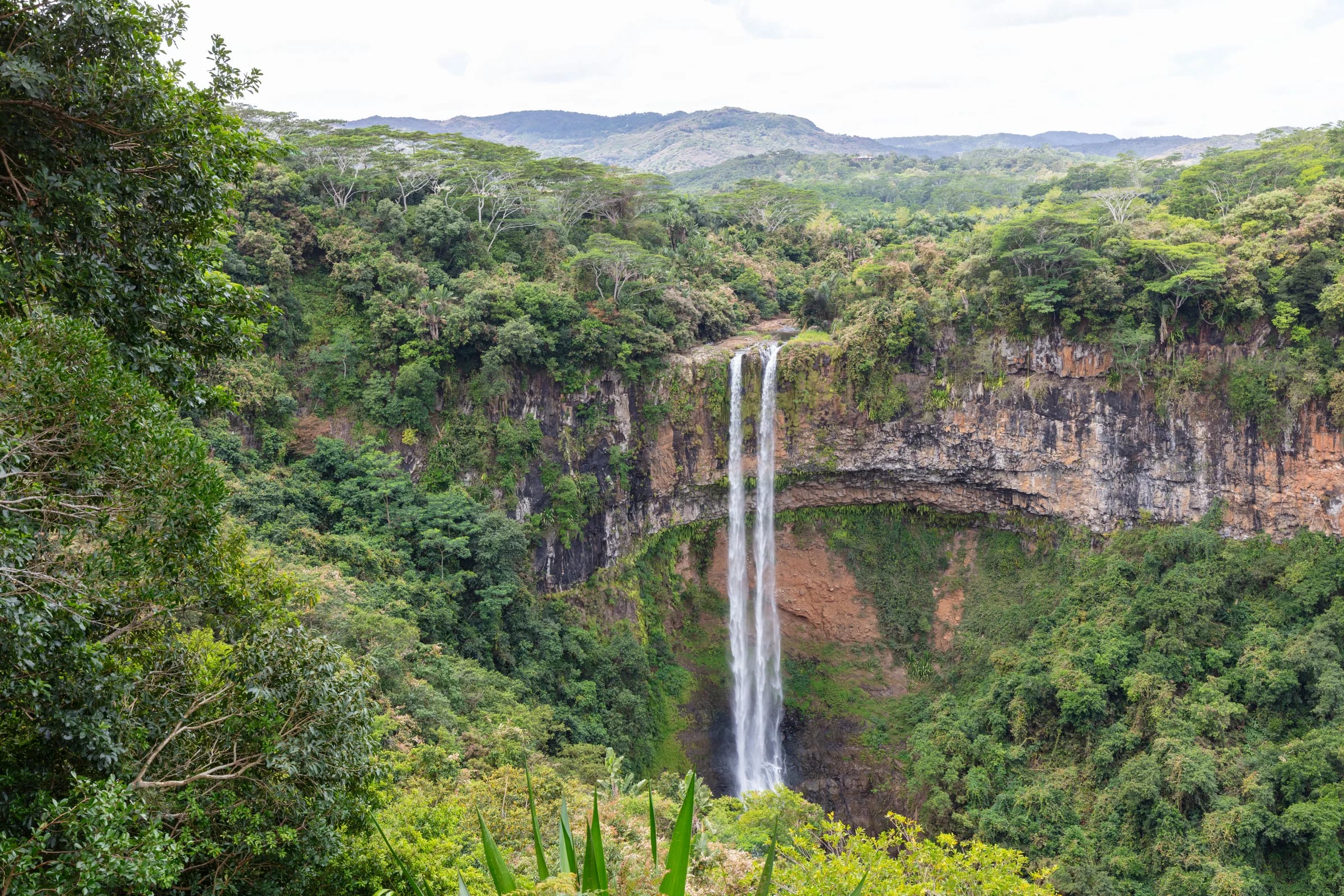
Why the Chamarel Waterfall hike is guided only
The Chamarel Waterfall hike is guided only because the Chamarel Seven Coloured Earth Geopark, whose ticket covers the two viewpoints above the gorge, states in its FAQ that going down the waterfall on your own is strictly prohibited. The geopark gives no reasons. The path is slippery and runs through dense forest, the river can rise quickly after rain and the route has never been published, which together make the base no place to explore without someone who knows the way.
The geopark’s FAQ recommends a local guiding company for the descent, and its waterfall page also points visitors to guides. Online resellers sell the same kind of outing and repeat that you cannot hike there on your own. Ask at the geopark ticket office which guide the park currently recommends.
There is no official price for the Chamarel Waterfall hike. On 29 October 2026 resellers were asking roughly €70 per adult for a 3-hour version that includes the geopark ticket but not transport, and about £111 to £116, or US$140, for versions with hotel pick-up. Check what is included, especially the geopark ticket and transport, before paying.
What the descent involves
The Chamarel Waterfall hike, as it is sold, is an outing of about 3 hours that starts at the car park of the Chamarel Seven Coloured Earth Geopark, continues by car to the start of the path, descends through forest to the pool at the foot of the fall and then returns. No mapped route has been published, so the stages below follow the outing as it is sold.
Meeting at the geopark
Guided outings meet at the entrance car park of the Chamarel Seven Coloured Earth Geopark. Some include the geopark ticket and some include hotel transfers, so confirm both when you book. The gate opens at 08:30 (checked on 29 October 2026).
The drive to the start
The guide drives the group from the car park to the start of the path. Neither the geopark nor the guides publish where that start is, which is one more reason not to look for it alone.
The descent
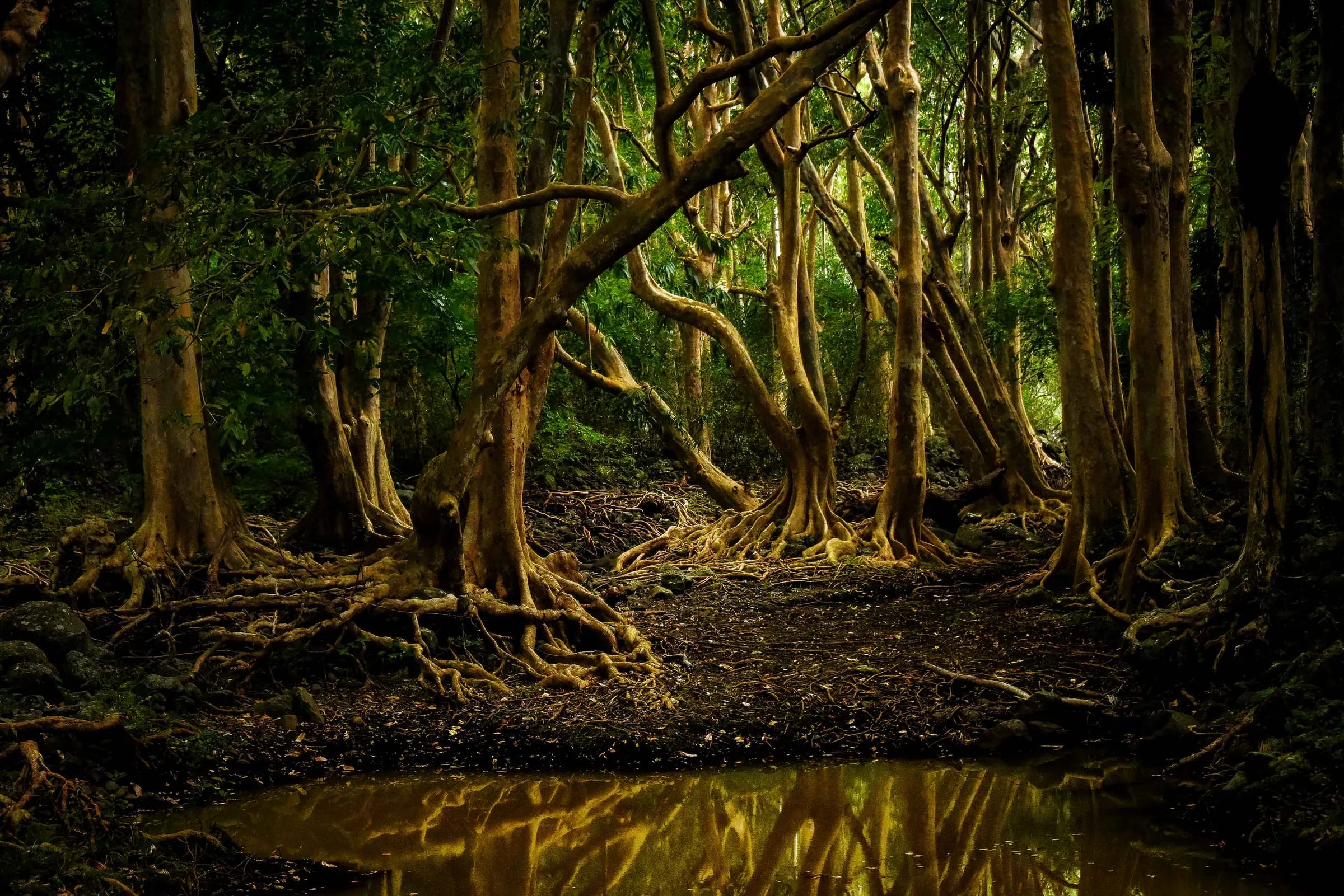
The descent takes about 45 minutes on a forest path that is slippery in places and suits experienced walkers. The trail winds through dense foliage.
At the foot of the fall
The descent ends at the pool below the 83 to 100 m drop, where the spray can rise to about half the height of the fall. Most outings include a swim here, and whether to take it is dealt with below.
The way back
The way back out is not described or timed separately. The advertised total of about 3 hours covers the descent, the time at the pool and the return.
Mud, rock and river crossings
The path to the base of Chamarel Waterfall is slippery, and forest paths in this part of Mauritius turn muddy in the rainy summer from November to April, when Mauritius receives about two thirds of its rain.
February and March are the wettest months island-wide and October the driest, so the ground is most likely to be firm from about September to November, when the fall itself is at its thinnest. In the neighbouring Black River Gorges National Park the walking season is the drier months, from about April or May to October or November, and paths turn slippery after rain. The same logic applies on the waterfall path.
Whether the descent crosses the river is not published. River crossings in these hills are on slippery rocks, as on the Parakeet trail in the Black River Gorges and in the river below the 500 Pieds fall near Alexandra Falls. If your route crosses water, ask the guide how it is crossed and what happens when the river is high, and never wade through fast-flowing water.
Can you swim at the base of Chamarel Waterfall?
Swimming at the base of Chamarel Waterfall is advertised by the guided hikes, and no rule from the Chamarel Seven Coloured Earth Geopark or any other authority settles whether it is allowed. The case against it is unpredictable currents and the risk of flash floods; the case for it is that a dip in the small pool at the foot is possible. The geopark’s code of conduct does not mention swimming.
Advice to swim at the bottom without a local guide circulates online and conflicts with the geopark’s ban on going down alone. No drowning or rescue at the fall is on record in the English or French press that can be searched online, which is no evidence that the pool is safe, because Mauritian press archives are not fully searchable.
If you swim, do so only where and when your guide says the water is safe, stay out after heavy rain and do not go in unless you are a confident swimmer.
Staying safe on the descent
The main risks on the Chamarel Waterfall descent are a slip on wet ground, water that rises after rain and an unreliable phone signal in the forest, so go only with a local guide, in settled weather and in shoes with real grip.
- Postpone the descent after heavy rain or when heavy rain is forecast. The Chamarel Seven Coloured Earth Geopark itself closes during cyclone warnings and very heavy rain, and the cyclone season runs roughly from November to April, with warnings possible until mid-May.
- Wear closed shoes with a good grip, carry water and keep your phone charged, but do not count on a signal once you are below the rim of the gorge.
- Tell someone outside the group where you are going and when you expect to be back.
- In an emergency in Mauritius, call 999 for the police (112 also works), 114 for the SAMU ambulance or 115 for the fire service.
- There is no hospital in Chamarel. The nearest public hospital is the Dr Yves Cantin Community Hospital in the Rivière Noire district (also spelled Catin), and private clinics are on the coast around Tamarin.
What is not published about the path
Neither the geopark nor the guiding companies publish where the Chamarel Waterfall hike starts, how long the path is, how much height it loses or who owns the land it crosses, so treat any confident claim about those details with care.
What is known is limited. Guided outings meet at the car park of the Chamarel Seven Coloured Earth Geopark and drive to the start, so the start is away from the viewpoints. No route from the Rivière du Cap or Baie du Cap side has been described. Route-planning maps show a loop of about 17 to 18 km from Chamarel that passes the falls, with no public way down to the pool, and the loop does not change the geopark’s rule. The times on record are about 45 minutes for the descent itself and about 3 hours for the whole outing.
Land status matters in this area. The base of the 500 Pieds waterfall below Alexandra Falls, about 7 km away on the plateau, lies on private land, and walkers need the landowner’s authorisation to reach it. Whether anything similar applies at Chamarel is not documented. Before you pay, ask the guide these questions.
- Where does the walk start, and how long and steep is it?
- Does the route cross the river, and what happens if the water is high?
- Is a swim included, and who decides on the day whether it is safe?
- Are the geopark ticket and transport included in the price?
- What happens if it rains, and what are the cancellation terms?
Seeing the fall without the hike
You can see the whole drop of Chamarel Waterfall without hiking from the two railed viewpoints inside the Chamarel Seven Coloured Earth Geopark, a few steps from their car park, on the standard ticket of Rs 800 for non-resident adults and Rs 400 for children aged 5 to 11 (checked on 29 October 2026). The platforms face the fall across the gorge from about 240 m away.
Specialist operators have offered abseiling from the top of the fall in the past, and no current provider or price is published. If the aim is a waterfall swim rather than this particular fall, the VALLÉ Advenature Park (formerly La Vallée des Couleurs) at Chamouny, about 22 minutes by road from Chamarel, has natural waterfalls where swimming is allowed. Its entry costs Rs 550 for non-residents aged 12 and over (checked on 29 October 2026).
Questions people ask
Can you hike to the bottom of Chamarel Waterfall on your own?
No. The Chamarel Seven Coloured Earth Geopark states that going down to the bottom of Chamarel Waterfall on your own is strictly prohibited, and no public path to the base is published. The base is reached only on guided outings, which meet at the geopark car park and drive to the start of the path. The standard geopark ticket covers the two viewpoints, not the descent.
How long is the Chamarel Waterfall hike?
The Chamarel Waterfall hike is sold as an outing of about 3 hours, including the meeting, the descent, time at the pool and the return. The descent itself takes about 45 minutes. The length of the path and the height it loses are not published by the geopark or the guides, so ask your guide before you go.
How much does the Chamarel Waterfall hike cost?
The Chamarel Waterfall hike has no official published price. On 29 October 2026 resellers were asking roughly €70 per adult for a 3-hour version that includes the geopark ticket but not transport, and about £111 to £116, or US$140, with hotel pick-up. The geopark ticket alone costs Rs 800 for non-resident adults (checked on 29 October 2026) and covers only the viewpoints.
Is the hike included in the Chamarel geopark ticket?
The Chamarel Waterfall hike is not included in the standard Chamarel Seven Coloured Earth Geopark ticket, which covers the two waterfall viewpoints, the coloured earth, the giant tortoise park and the endemic garden. The geopark’s FAQ lists the hike as excluded. Some guided outings include the geopark ticket in their price and some do not, so check before paying.
How hard is the Chamarel Waterfall hike?
The Chamarel Waterfall hike is short but demanding underfoot. The descent takes about 45 minutes on a forest path that is slippery in places, especially after rain, and suits experienced walkers. Distance and height loss are unpublished. Anyone unsteady on wet, uneven ground will see more of the fall, with less risk, from the viewpoints inside the geopark.
When is the best time of year for the Chamarel Waterfall hike?
The Chamarel Waterfall hike is firmest underfoot in the drier months, roughly May to November, and October is the driest month in Mauritius. The fall is fuller from December to April, but those are also the months of muddy paths, rivers that rise after storms and cyclone warnings that can close the geopark. Whatever the month, postpone the hike after heavy rain.
How do you get to Chamarel Waterfall?
Chamarel Waterfall is reached through the Chamarel Seven Coloured Earth Geopark, whose gate is on the B104 about 1.5 km south of Chamarel village. To see the fall, drive 1.5 km inside the park to the waterfall car park and walk a few steps to the viewpoints. To reach the base, join a guided outing, which meets at the geopark car park and drives to the start of the path.
See the fall without the hike
The two railed viewpoints inside the geopark show the whole drop on the standard ticket, with no descent at all.