
Chamarel history, from the de Chazal estate to the geopark
Chamarel history in short is a land grant to the de Chazal de Chamarel brothers in 1785 or 1786, a sugar mill that ran until 1897, a hill settled by freed slaves after abolition in 1835, and tourism from the late 1960s, when the coloured earth became a visit. Coffee growing was revived in the 1960s, the Rhumerie de Chamarel opened in 2008 and UN Tourism listed the village among its Best Tourism Villages in 2025. The records differ on several dates, and this page gives both values wherever they do.
Read the guide
The de Chazal de Chamarel family and the first estate
Chamarel’s recorded history starts with the de Chazal de Chamarel brothers, Toussaint-Antoine and Charles-Antoine, born on the island in 1770 and 1772, who acquired an estate called Le Nuage from their stepfather, the notary Jean Louis Lousteau, in the 1780s.
The records differ on the details. The land came to the stepsons in 1785 in the family record, as a bequest from Lousteau, the first settler, and in 1786 in the geopark’s account, as a concession of 625 acres to the sons of François de Chazal de la Genesté. Charles-Antoine settled around 1793, cut the forest for timber and tried coffee, indigo, cotton and sugar cane. He married Marie Anne Augustine de Saint-Félix in 1799 and had six daughters, then left for France and never returned. The records differ on the year of his departure, 1810 or 1815.
One popular story does not hold up. No record places Matthew Flinders, the British navigator held in Mauritius during the Napoleonic Wars, in Chamarel; his detention was on parole at the d’Arifat family’s Le Refuge estate near Mare aux Vacoas.
Sugar on the hill until 1897
Sugar was milled at Chamarel from the middle of the 19th century until 1897, when the factory closed for good.
The first factory is dated about 1845, when Charles-Antoine’s daughter Marie Amélie returned to the estate and built it, or 1860, after the land was sold in 1844 and bought back in 1852 by Amélie’s husband, Amédée Perrot. By 1872 the estate covered 2,949 acres, 450 of them under cane. Amélie left Chamarel in 1875 and died a year later in a convent in Port Louis.
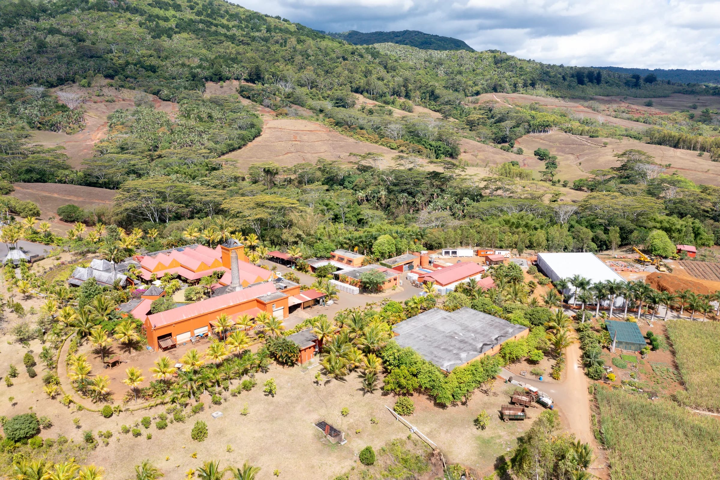
The estate was sold in 1891 to The Mauritius Estate & Assets, which renovated the factory in 1894 and stopped it in 1897. Its chimney, the last remnant, still stands on the La Vieille Cheminée estate, now a farm with eco-lodges on the B104. In 1961 the Compagnie Sucrière de Bel Ombre bought Chamarel together with Case Noyale, bringing the hill into the Bel Ombre estate, whose successor company is Agrïa.
Maroons, freed slaves and the Valley of Blacks
Chamarel’s isolation shaped its people, because the valley, cut off from the rest of the south by peaks, sheltered runaway slaves known as maroons, and after abolition in 1835 it became a place where freed people chose to settle.
Some residents call it the Valley of the Blacks, and the nickname Valley of Blacks was given by freed slaves, as UN Tourism’s 2025 profile records. Chamarel and Le Morne stand as two maroon villages and rare symbols of Creole self-determination, and UNESCO documents maroon settlements around Le Morne Brabant through the 18th and early 19th centuries.
The same isolation had other consequences. The valley ran an illicit trade in alcohol and cannabis and distilled a raw cane spirit called tilambik outside the law, families foraged, hunted and ground maize by hand through the hardship of the Second World War, and the legend of Madame Bell, whose phantom bells are linked to the spirits of enslaved people, belongs to the same hill. Contact with the outside came slowly, with the road up from Case Noyale built in the 19th century and a telephone line, ordered by Thomi Pitot, arriving around 1900.
Coffee, from the first planters to the 1970 harvest
Coffee has been grown at Chamarel twice, first by Charles-Antoine de Chazal in the 1790s and again since a revival in the 1960s that produced its first Arabica harvest in 1970.
Coffee reached Mauritius in 1715, with Mocha plants introduced by Guillaume Dufresne. The revival came with the Bel Ombre sugar company. The restart is dated to 1961, when the company took over Chamarel and Case Noyale, with a drying and roasting plant at Case Noyale in 1967, or to 1967 itself, under Case Noyale Ltd and helped by Oswald du Chasteleer, who had grown coffee in the Belgian Congo. The first Arabica harvest came in 1970.
The plantation is still worked today. It grows at 280 m beside the geopark, is picked by hand from May to July and takes visitors on guided tours at 09:00, 11:00, 13:00 and 15:00, priced at Rs 1,000 for a non-resident adult when checked on 29 October 2026. The plantation is recorded at 12 ha and at 16 ha.
How the coloured earth became a visit
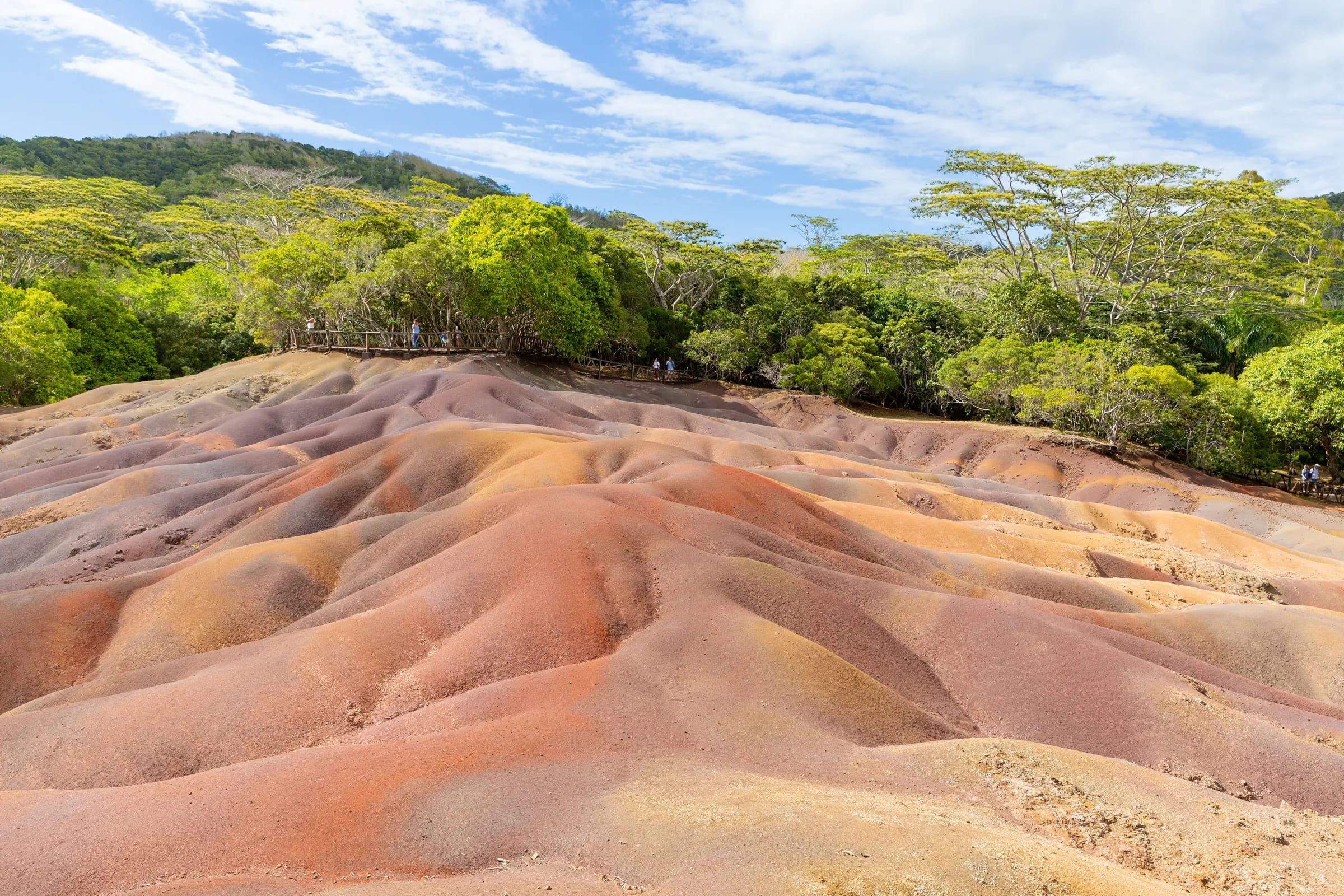
The coloured earth was first recorded at a session of the Royal Society of Arts and Sciences of Mauritius on 26 November 1879, and became a visit in the late 1960s.
The geopark’s own history dates the first tourism to 1960 and says the site has shaped the identity of Chamarel since the late 1960s, and a 1960s photograph of the site survives in the archives.
Human history also shaped how the dunes look. The 2010 study by Sheth, Johnson and Ollier in the Journal of African Earth Sciences attributes the colours to basalt weathered into iron oxides and the rills to erosion after the surrounding forest was cleared, and the Bel Ombre estate record adds that people cleared the area before a severe storm stripped the topsoil.
Visiting has become much more expensive. An adult paid Rs 200 to Rs 250 in 2018 and 2019, and a non-resident adult pays Rs 800 at the official price checked on 29 October 2026.
The Rhumerie de Chamarel since 2008
The Rhumerie de Chamarel opened in 2008, and its 2026 cane harvest was the 18th since the opening.
The Couacaud family bought the Domaine de l’Exil in 1996 and decided in 2008 to build a distillery that would make rum only from the juice of its own cane, grown on about 220 ha. The company, L’Exil Ltée, is led by the two eldest brothers, and the building, designed by the architect Maurice Giraud, combines wood, stone and water. The date 1996 that circulates for the rum is the year of the land purchase, not of the first distillation.
Legal rum also closed an older chapter. Tilambik, the illicit cane spirit that once supported many families, has given way to the refined rum now tasted at the Rhumerie.
The geopark and the village today
Today the coloured earth is run as the Chamarel 7 Coloured Earth Geopark, an 8.5 ha site that calls itself Mauritius’ first geopark and is operated by ER Hospitality, the leisure arm of ER Group, known until about 2025 as Rogers Hospitality.
The geopark does not publish who owns the land under the dunes or exactly when the current operator took over. Conservation has grown alongside tourism, with the Mauritian Wildlife Foundation and the geopark removing invasive plants and planting natives since 2009, and Ebony Forest restoring native forest nearby since 2006.
The direct road to the west coast was cut in September 2021, when part of the B104 between Case Noyale and the village closed for about a year for landslide and slope works, and the rebuilt 1.4 km section had been inaugurated by Prime Minister Pravind Jugnauth by early December 2022. On 17 October 2025 UN Tourism listed Chamarel among its 52 Best Tourism Villages.
Chamarel history timeline, with the disputed dates
This Chamarel history timeline lists the key dates in order, with the alternative date wherever the records differ.
| Year | What happened | Where the records differ |
|---|---|---|
| 1715 | Coffee reaches Mauritius | None |
| 1785 or 1786 | The de Chazal de Chamarel brothers acquire the land | 1785 in the family record, 1786 in the geopark’s account |
| About 1793 | Charles-Antoine settles and plants coffee, indigo, cotton and cane | None |
| 1810 or 1815 | Charles-Antoine leaves for France | 1810 or 1815, the records differ |
| 1835 | Slavery is abolished and freed people settle the valley | None |
| About 1845 or 1860 | The first sugar factory is built | About 1845 or 1860, the records differ |
| 1876 | The Sainte-Anne chapel is built | The parish church itself is dated 1971 |
| 1879 | The coloured earth is recorded by the Royal Society of Arts and Sciences | None |
| 1891 to 1897 | The estate is sold, its factory renovated in 1894 and closed in 1897 | None |
| About 1900 | A telephone line links Chamarel to the rest of the island | None |
| 1961 | The Bel Ombre sugar company buys Chamarel and Case Noyale | None |
| 1960s | Coffee is revived, with a first Arabica harvest in 1970 | Restart dated 1961 or 1967 |
| Late 1960s | The coloured earth opens as a visit | The geopark also dates the first tourism to 1960 |
| 2006 | Restoration begins at Ebony Forest | UN Tourism gives 2017, when the visitor centre opened |
| 2008 | The Rhumerie de Chamarel opens | 1996 also circulates, the year the estate was bought |
| 2021 to 2022 | The B104 from Case Noyale closes for about a year and is rebuilt | None |
| 2025 | UN Tourism lists Chamarel as a Best Tourism Village | None |
Questions people ask
Who was Chamarel named after?
Chamarel was named after Charles Antoine de Chazal de Chamarel, born on the island in 1772, who acquired the land with his elder brother Toussaint-Antoine from their stepfather, Jean Louis Lousteau, in 1785 or 1786. Charles-Antoine settled on the estate around 1793 and grew coffee, indigo, cotton and sugar cane before leaving for France in 1810 or 1815, the records differ. The family name stayed with the village after the land was sold.
When was Chamarel founded?
Chamarel has no single founding date. The land passed to the de Chazal de Chamarel brothers in 1785 in the family record, or as a concession in 1786 in the geopark’s account, and Charles-Antoine de Chazal settled there around 1793. The village grew in the 19th century around a sugar estate, and freed people settled on the hill after slavery was abolished in 1835.
Why is Chamarel called the Valley of Blacks?
Chamarel is called the Valley of Blacks, or the Valley of the Blacks, because of its history as a refuge and home for enslaved people. Freed slaves gave the village the nickname, as UN Tourism’s 2025 profile records, and the isolated valley sheltered maroons, or runaway slaves, and became a preferred place to settle after abolition in 1835. Some residents use the name today.
Did Matthew Flinders stay in Chamarel?
No. No record places Matthew Flinders in Chamarel. The British navigator, held in Mauritius during the Napoleonic Wars, was under house arrest at the Jardin Despeaux and then on parole at the d’Arifat family’s Le Refuge estate near Mare aux Vacoas, as the Société de l’Histoire de l’île Maurice sets out. The Chamarel story circulates without a record behind it.
When did the Seven Coloured Earth become a tourist attraction?
The Seven Coloured Earth became an attraction in the 1960s. The site was first recorded at a session of the Royal Society of Arts and Sciences of Mauritius on 26 November 1879, and the geopark dates the first tourism to 1960 and the launch of the park to the late 1960s. A photograph from that decade survives in the archives.
When did the Rhumerie de Chamarel open?
The Rhumerie de Chamarel opened in 2008, and its 2026 harvest was its 18th. The Couacaud family bought the Domaine de l’Exil in 1996 and in 2008 decided to build a distillery making rum only from the juice of its own cane, grown on about 220 ha. The date 1996 that also circulates is the year the estate changed hands, not the year distilling began.
Is anything left of Chamarel’s sugar mill?
Chamarel’s sugar mill survives only as its chimney, which stands on the La Vieille Cheminée estate, now a farm with eco-lodges on the B104. The factory was built in about 1845 or in 1860, the records differ, and was renovated in 1894 by The Mauritius Estate & Assets and closed in 1897. Cane is still grown on the slopes, and the Rhumerie de Chamarel now turns its own cane into rum.
See the village today
The village page covers the Sainte-Anne church, the July fair, the people of Chamarel and the practical facts for a visit.