
Hiking Piton de la Petite Rivière Noire, the highest point of Mauritius
Piton de la Petite Rivière Noire, also called Black River Peak, is the highest point of Mauritius at 828 m, and the usual hike from the Plaine Champagne road (B103) above Chamarel is 6.25 to 7 km return and takes most people 2 to 4 hours. Because the trailhead is already at 682 m, the climb is only about 150 to 340 m depending on how the dips are counted, but the path is often muddy and ends in a steep, slippery scramble with ropes and a handrail. On a clear day the summit view runs along the west coast from Le Morne to Flic en Flac.
Read the guide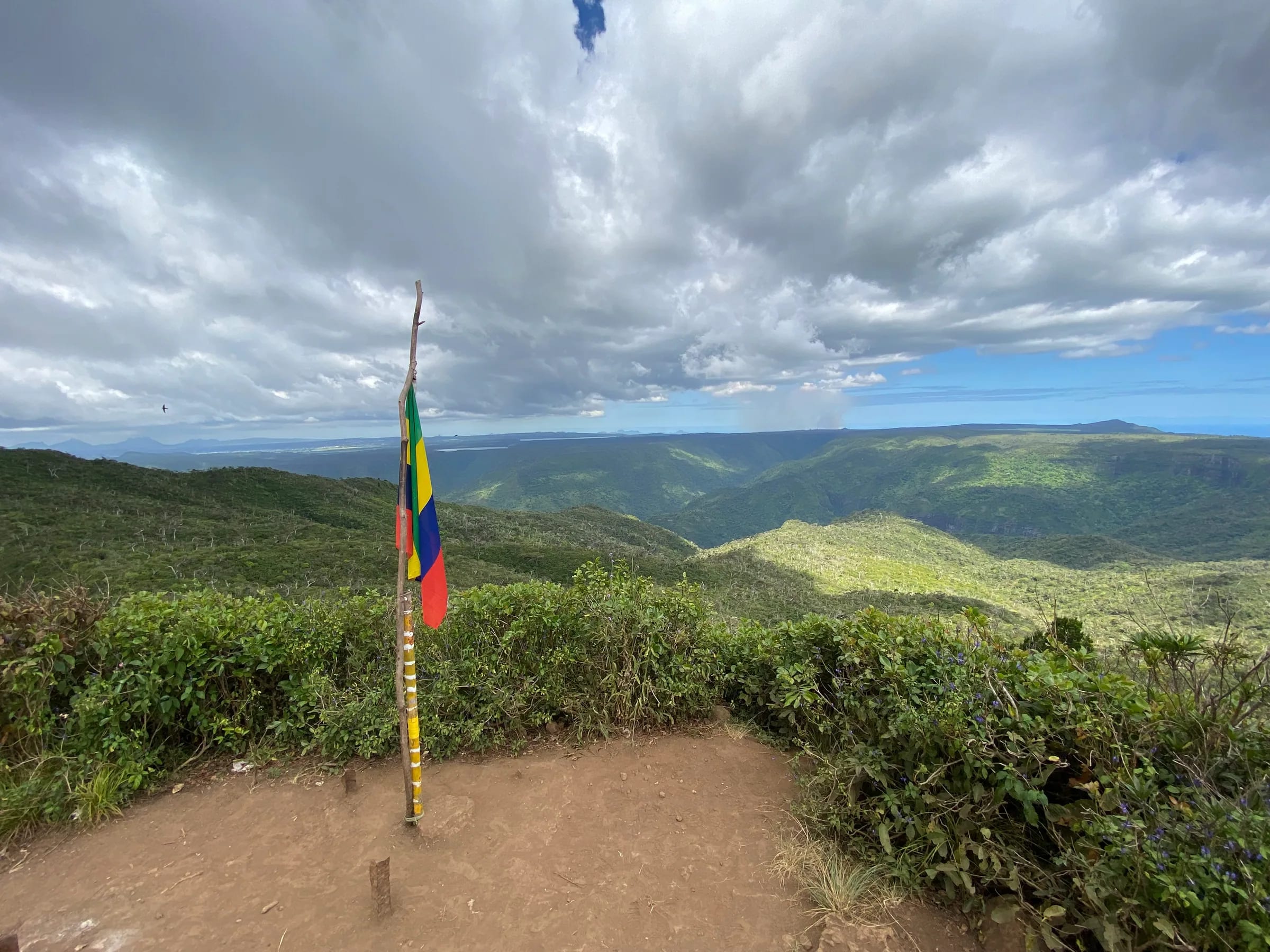
Is Piton de la Petite Rivière Noire the highest mountain in Mauritius?
Yes, Piton de la Petite Rivière Noire, known in English as Black River Peak, is the highest mountain in Mauritius at 828 m, ahead of Pieter Both at 820 m and Le Pouce at 812 m.
The summit stands in Rivière Noire district, in the Black River range of the south-west, about 2.5 km north-east of Chamarel village as the crow flies. Pieter Both and Le Pouce, the second and third highest summits, rise in the Moka range behind Port Louis, and both are better known than the highest peak. A bench on the summit is called Bench 828.
Height and effort are not the same thing here. The Black River Peak trailhead is already at 682 m, so the walk climbs less than the hikes to lower summits that start nearer the sea, as the figures below show.
| Hike | Summit | Usual start | Climb | Distance | Time, return |
|---|---|---|---|---|---|
| Black River Peak | 828 m | Plaine Champagne road, 682 m | About 150 to 340 m | 6.25 to 7 km return | 2 to 4 h |
| Le Pouce | 812 m | Petit Verger above Saint-Pierre, about 381 m | About 390 m | 2.05 km each way | 2 to 3 h |
| Lion Mountain | About 480 m | Vieux Grand Port police station | About 400 m | 1.8 km each way | 3 to 4 h |
Where the Black River Peak trail starts
The Black River Peak trail starts on the Plaine Champagne road (B103) at -20.42334, 57.42626, at 682 m, beside a large rock painted with a hiker, about 350 m west of the Gorges viewpoint.
Driving up from Chamarel, the start comes just after the road enters the Black River Gorges National Park, about 3.7 km east of the village as the crow flies. Parking is tight. Two or three cars fit at the trailhead, there is one space opposite the start and a car park about 200 m further on, and the Gorges viewpoint car park is the fallback. Between mid-April and mid-May, when people come up to pick Chinese guava, the road fills with heavy traffic and badly parked cars.
The walk is free, with no permit, ticket or booking (checked on 29 October 2026). The national park’s gates can shut as early as 17:00, so plan to be back at the car before then.
The Black River Peak route stage by stage
The route is an out-and-back on one path, described here from the GPS track, whose distances run slightly shorter than the rounded figures in circulation.
The road and the boundary stone
From the painted rock the path heads west into the forest and, after about 190 m, reaches a stone that marks the boundary between two districts, still at about 684 m. The ground is level at first.
West to Piton Saint-Denis
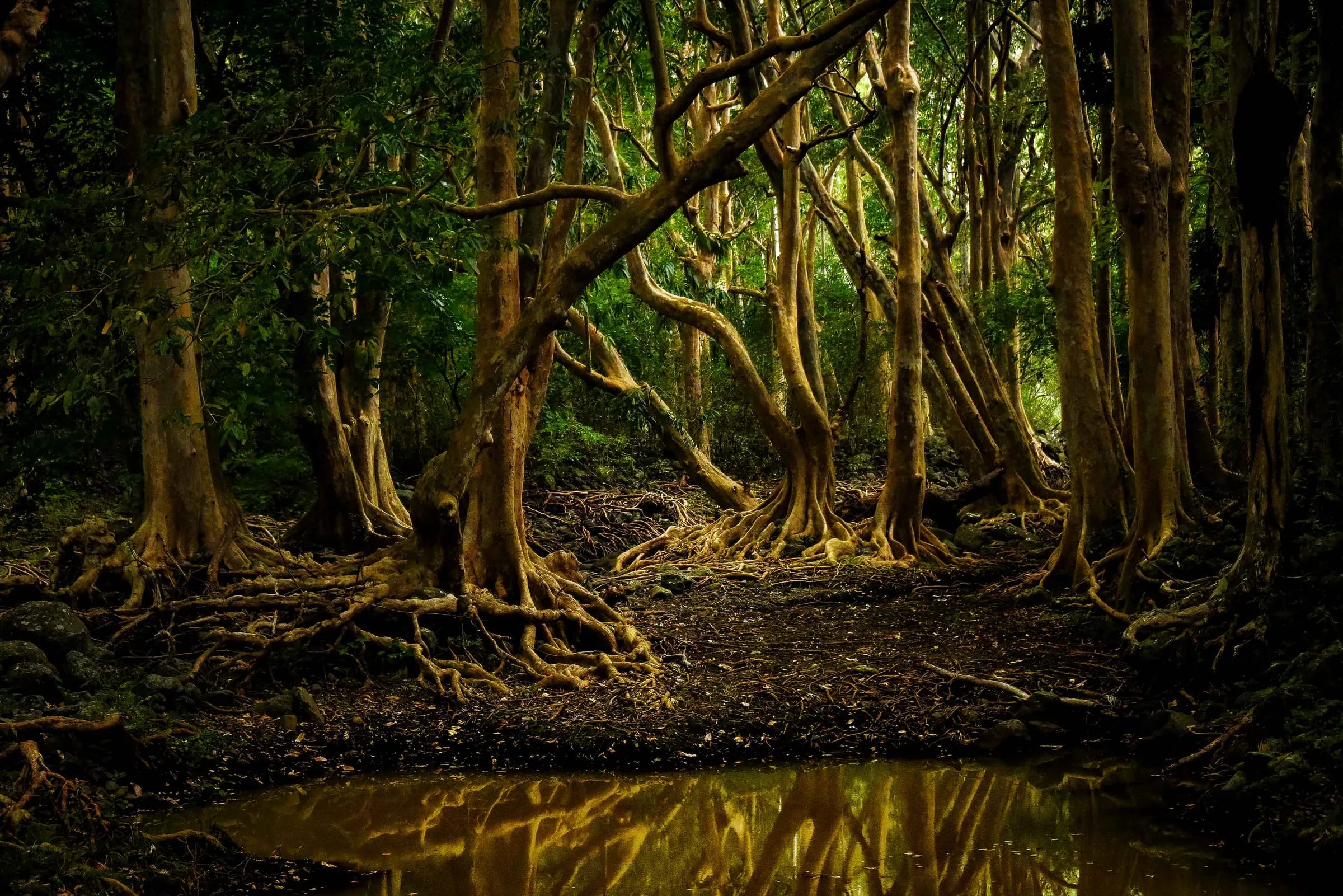
The path keeps west and then north-west to the top of Piton Saint-Denis, which the track reaches after about 1.9 km. This is the long, mostly shaded middle of the walk, through forest with roots, standing mud and boggy patches that linger long after rain. Paint marks on the rocks show the way, but the route is poorly marked in places.
North to the summit
At Piton Saint-Denis the route turns north and winds through forest to the summit, which the track reaches after about 3.15 km. The last 200 m or so are in full sun, and the final metres are steep and slippery, with a handrail and fixed ropes or chain to hold. The roped passages feel more technical on the way down.
The summit and the way back
The summit has a bench, Bench 828, and a 360° view. On a clear day the whole west coast opens up, from Le Morne to Flic en Flac, with the lagoon below. In cloud you see very little. The return follows the same path, about 3.1 km back to the road, and the descent of the final rock and the mud below it needs the most care.
How long is the Black River Peak hike?
The Black River Peak hike is 6.25 to 7 km return, depending on how it is measured, and most people take 2 to 4 hours including time on the summit.
The GPS track measures 6.25 km with 213 m of climbing and an average of 2 hours 25, and walkers on it take anything from 2 hours to 3 hours 50. The rounded figures in circulation are 6.4 km with about 150 m of climbing in 3 to 4 hours, 4 miles, about 6.4 km, with 336 m of climbing between 619 and 821 m, and 7 km in 3 to 4 hours. The climb figures differ because the path rises and falls on the way. The trailhead and the summit are only 146 m apart in height, and the dips along the way add the rest.
For planning, allow 3 to 4 hours and start by 09:00. Quicker walkers in dry weather may take nearer 2 hours 30, but mud slows everyone more than the climb does.
| Figure | Distance, return | Climb | Time, return |
|---|---|---|---|
| GPS track | 6.25 km | 213 m | 2 h 25 average, 2 h to 3 h 50 for walkers on it |
| Shortest climb figure | 6.4 km | About 150 m | 3 to 4 h |
| Largest climb figure | About 6.4 km (4 miles) | 336 m (1,104 ft) | Not given |
| Longest distance figure | 7 km | Not given | 3 to 4 h |
How hard is the Black River Peak hike?
The Black River Peak hike is moderate, and its difficulty comes from mud, roots and a steep, slippery finish rather than from distance or height gain.
Few hikes in Mauritius are as slippery, and it only feels hard in the mud. The forest floor is often muddy even in dry weather and stays boggy long after rain, and the final rocky section needs hands, with ropes and a handrail to help. The path is shaded for nearly 4 km of the round trip. There are no exposed drops on this route, so the main risk is a slip on wet rock or mud.
Avoid the hike after several days of rain, when the ground becomes very slippery, and wear shoes with deep grip rather than smooth trainers. May to November is the best season. Long-tailed macaques are sometimes on the path, so keep food packed away, and carry water, since there is none on the route.
Do you need a local guide for Black River Peak?
Black River Peak can be walked unguided if you are used to forest trails and the weather is dry. For beginners, or after rain, a local guide is the safer choice.
Paint marks on the rocks show the way, but the path is poorly marked and steep in places. If you go alone, load a GPS track before you leave the road, since mobile signal is unreliable on forest trails, tell someone your plan, and turn back at the final rock if it is wet. In an emergency call the police on 999 (112 also works) or the SAMU ambulance on 114.
The wrong summit coordinate online
The summit coordinate that circulates online for Piton de la Petite Rivière Noire, 20.400°S 57.467°E as shown on 29 October 2026, is about 6 km from the real summit, so do not navigate to it.
That point lies about 6.3 km east-north-east of the peak, roughly 1 km from the Pétrin information centre on the far side of the national park. The summit is at -20.40879, 57.40769, at 828 m, which matches the trail. Navigate to the trailhead at -20.42334, 57.42626 and follow the path from there.
Questions people ask
What is the highest mountain in Mauritius?
The highest mountain in Mauritius is Piton de la Petite Rivière Noire, also called Black River Peak, at 828 m in the south-west, near Chamarel. Pieter Both, at 820 m, and Le Pouce, at 812 m, both in the Moka range behind Port Louis, are the second and third highest. Black River Peak is also one of the easier summits to reach, because its trailhead is already at 682 m.
How long does the Black River Peak hike take?
Most hikers take 2 to 4 hours for the Black River Peak hike, there and back from the Plaine Champagne road. The GPS track averages 2 hours 25 for 6.25 km, walkers on it take 2 hours to 3 hours 50, and the safe allowance is 3 to 4 hours. Mud after rain is what slows people most, so allow the longer time if it has been wet.
Where does the Black River Peak trail start?
The Black River Peak trail starts on the Plaine Champagne road (B103) at -20.42334, 57.42626, about 682 m above sea level, beside a large rock painted with a hiker. The start is about 350 m west of the Gorges viewpoint. Parking at the trailhead fits only two or three cars, so use the viewpoint car park when it is full.
Is the Black River Peak hike difficult?
The Black River Peak hike is moderate rather than hard. The climb is only about 150 to 340 m, but the path is muddy, rooty and often slippery, and the last metres to the summit are steep, with ropes and a handrail. Few hikes in Mauritius are as slippery. Good shoes and dry weather matter more than fitness.
Do you have to pay to climb Black River Peak?
Climbing Black River Peak is free, with no ticket, permit or booking (checked on 29 October 2026). The trail is in the Black River Gorges National Park, which charges no entry fee. Guided hikes are sold privately. The national park’s gates can shut as early as 17:00, so start early enough to be down well before then.
What can you see from Black River Peak?
The summit of Black River Peak has a 360° view, and on a clear day the west coast opens up from Le Morne to Flic en Flac, with the lagoon below. The full view needs fine weather, since cloud builds over the plateau as the day warms, so a clear morning in the drier months from May to November gives the best chance.
Why is the Wikipedia location of Black River Peak wrong?
The coordinate in question, 20.400°S 57.467°E as shown on 29 October 2026, falls about 6 km east of the real summit, close to the Pétrin information centre. The summit is at -20.40879, 57.40769, which matches the trail. Navigate to the B103 trailhead instead and follow the path from there.
Compare the other hikes
The hiking page sets Black River Peak beside Macchabée, Parakeet, Piton Canot and the plateau walks, with honest grades and start points.